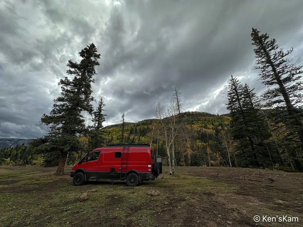
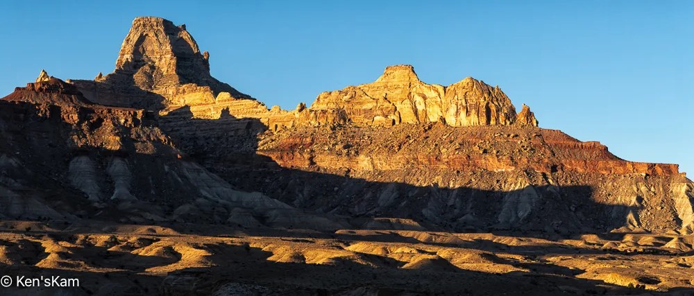
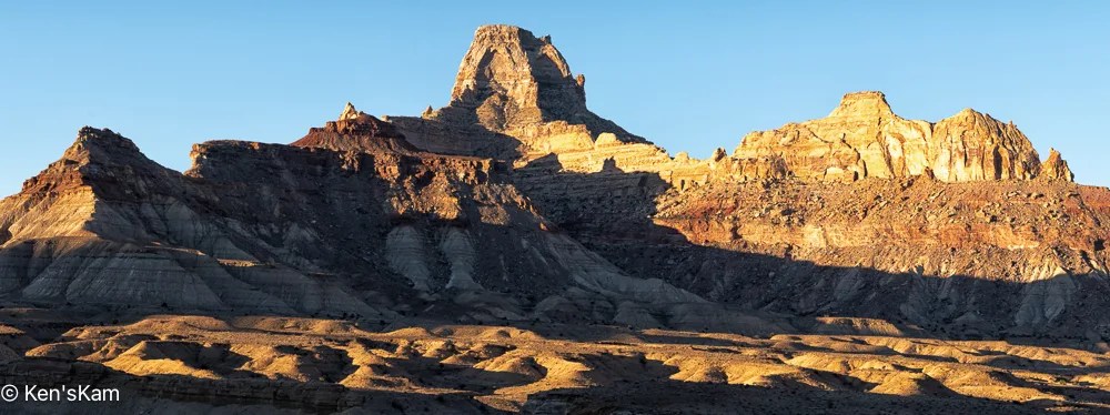
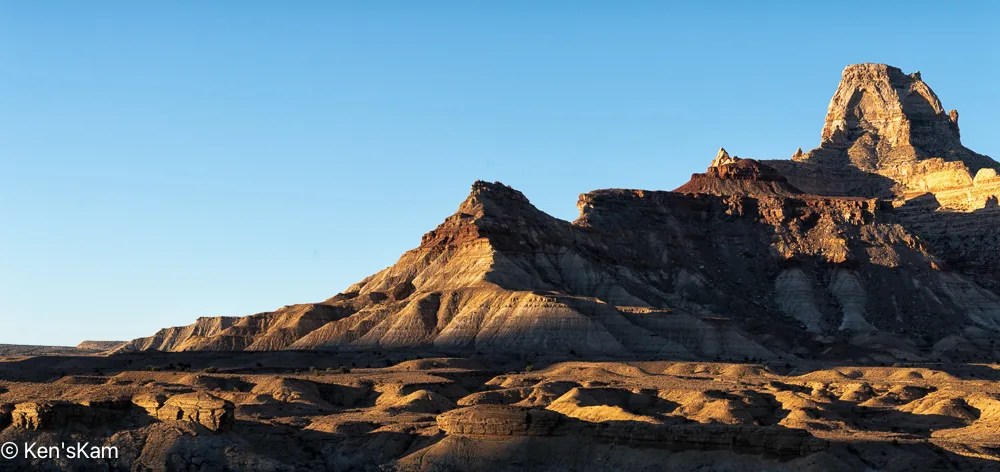
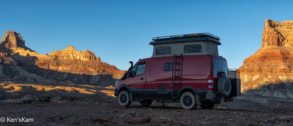
As we drove back along the route we had taken to get to Utah’s Little Grand Canyon, we stopped to check out a side road near a large campground, where we were considering staying; but as we explored the side road, we discovered more interesting scenery and plenty of open campsites at which to enjoy the scenery.
Our Campsite off of Mexican Mountain Road, Utah
Look closely and my Sportsmobile can be spotted near the center of this image. If just glancing at the image, the Sportsmobile might be mistaken for a natural feature.
This pano, made from our campsite, is of geological features across the roadway.
Across the Roadway 2Across the Roadway 3Near Sunset
We will shoot star photographs at this location. These images were taken not only to show the local scenery, but to select compositions for night sky foregrounds.
More local images and exploration images to follow,
It is spring (or almost) and time for another spring trip with my oldest son. Traveling in the U.S. for outdoor activities in the spring, one always has to consider the weather at potential destinations.
The initial plan this year was to fly into Portland, Oregon, drive to Cannon Beach for photography along the Oregon coastline, knowing that the typical rainy weather along the coast might result in last minute changes, and it did. The forecast for the time interval available for this trip was for cool, rainy, overcast weather every day, which can offer some opportunities for photography, but might not be so pleasant every day. So cancel plan A. Move to Plan B.
Plan B was to go to the same area as last year, where there were still some possibilities to see and photograph in some locales not visited during previous trips. Then a few days before executing Plan B, Plan C came up. Plan C was to explore an area of Utah seen superficially and partially, when passing through on the way to other destinations. Plan C was executed.
I drove two long days to reach the first destination, a first come first serve, free camping area on BLM (Bureau of Land Management) public land not far off of I70 west of Green River, Utah. This area is said to be popular with off roaders and I wanted to be sure to get here to find a campsite before the weekend crowd arrived. As it turned out, while there were a few scattered campers, including those hauling their offroad vehicles, there was no large crowd and I easily found a suitable campsite, somewhat secluded from others.
I shot the sunset panorama standing on the roof rack of my vehicle. If one looks closely, the tops of a few other campers can be seen in this image.
My son met me here to begin our exploration, making this our initial home base. Before he arrived, I had some time to walk around this area, shooting desert scenes with my iPhone. So stay tuned for part 2 to see some of those images.
Base camp for my spring 2025 photo outing was White House Trailhead and Campground. This site is on BLM land south of Highway 89, near Big Water, Utah, west of Page, Arizona.
I don’t know why the name “White House”. Maybe it is because of the white rocks at the campsite and all around this area.
When choosing a campsite, I use online apps and websites with reviews and photos from the campsites. I’m nearly always disappointed in the photos. It seems most campers and RVers mostly like to photograph their tents and RVs in a campsite, maybe the facilities and signs, but often don’t photograph much of the area around the campsite.
The White House Campground is not a large one, with only a few sites suitable for RVs; but it is in a beautiful location with massive rock features. There are more walk in tent sites past the end of the road at the campground. The pit toilets are well maintained, too. The campsites are on a first come, first serve basis, but there were plenty of open sites, when I arrived. Payment for the campsites is via an automated kiosk at the site. No need for a check or cash, as in the old days. Now a credit card is all that is accepted and discount cards such as Senior Passes for the National Parks and Public Lands are honored.
Sportsmobile in Campsite
After setting up in my chosen site, I walked around with my iPhone to capture a few images of the area.
I continued traveling along SD240 checking out views at numerous pullouts and/or viewpoints along the drive through the park. Checking the park area map, I noted other sections of the Buffalo Gap National Grasslands on the south side of the park. So I exited the park on the south side, drove SD 377 through the tiny community of Interior, SD, then along SD 44 West along the southern side of Badlands NP.
I topped off my fuel tank at an old convenience store/fuel station in Interior. The diesel pump was separate from the gasoline pumps and an old fashion type that is not commonly seen at more modern stations. The lady running the store/station was friendly. I purchased a copy of a paper back book, “Cactus Needles” that I spotted on display that was only $8. It is a book of hand drawn cartoons, cowboy poems and ranch stories by John F. Solon of Weta, SD, which is a little east of Interior.
About 6 miles west of Interior, I found an entrance into an area of Buffalo Gap National Grasslands that is set aside primarily for off-road vehicle use. The information sign near the entrance noted that rock hounding is permitted. Indeed, the area was strewn with rocks of many kinds and I saw one person walking around picking up rocks.
Camping is permitted here and I decided to make this my home base for at least one night, since it is conveniently located near an area that I planned to shoot at sunset.
Buffalo Gap National Grasslands, September 18, 2022, PM, iPhone Photo
I drove along a dirt route parallel to a fence line along the east boundary of this area and parked at a secluded location, which I planned to make my campsite tonight.
All Alone, Buffalo Gap National Grasslands, September 18, 2022, PM, iPhone Photo
I had this area completely to myself today. I had plenty of time prior to going back to the park for a sunset shoot, so I killed some time by reading the book that I had purchased in Interior and walking along a cow trail parallel to the fence line and shooting a few iPhone photos.
One Sided, Buffalo Gap National Grasslands, September 18, 2022, PM, iPhone Photo
I’m hoping that those big fluffy clouds hang around for my sunset shoot.
Cow Trail, Buffalo Gap National Grasslands, September 18, 2022, PM, iPhone PhotoCow Trail, Buffalo Gap National Grasslands, September 18, 2022, PM, iPhone Photo
Apparently, cows like to walk the same path repeatedly, since they have created such distinct and deep trails here.
Two Lanes, Buffalo Gap National Grasslands, September 18, 2022, PM, iPhone PhotoBuffalo Gap National Grasslands, September 18, 2022, PM, iPhone Photo
Looking back along the fence line towards my campsite. My Sportsmobile is hidden behind the trees. Although, if one enlarges this image, the Sportsmobile is partially visible.
After my morning excursion into Badlands National Park, I returned to the Buffalo Gap National Grasslands Campground Area, picked another campsite, had lunch and waited until it was time to go out again for sunset photography.
Buffalo Gap National Grasslands, September 16, 2022, PM, iPhone Photo 1Buffalo Gap National Grasslands, September 16, 2022, PM, iPhone Photo 2
As the afternoon progressed, like yesterday, storm clouds began gathering.
Visitors, Buffalo Gap National Grasslands, South DakotaPraire StormBuffalo Gap National Grasslands, Campsite 2
Rain soon began to fall with gusty winds. It was apparent that the storm was too fierce for me to venture back out for a late day shoot. Now I have to look forward to another morning shoot.
On my return trip from the Grand Canyon North Rim, my first overnight stay was near Gallup, New Mexico at Red Rocks Park. There were large red rock formations around the park and I thought this would be a good place to check out. It was not a bad place to stay for one night, but much less interesting than I had anticipated. At least the weather was mild, due to overcast and rain during the day, just before I arrived at the park, then a booming thunderstorm at night.
My second overnight was at Texas’s Palo Duro Canyon State Park near Amarillo. I had been through the park many years ago, but never spent much time here. My campsite was deep into the canyon. Even though it was late July, the weather was only mildly hot in the day and cooled down nicely at night.
After settling in, I walked around the area to scout potential locations for sunset and possibly sunrise photography. All of the scouting images in this post were made with my iPhone.
The Sportsmobile in Palo Duro Canyon Campsite.Small Cacti in Palo Duro Canyon
As in most western US deserts or arid places, cacti abound and one needs to watch where one steps.
Dinosaur Grafiti, Palo Duro Canyon
Visitors to this area have a penchant for carving into the rocks, which I assume must not be very hard rocks. I found this image of a dinosaur in a narrow space between large boulders.
Rock Grafitti, Palo Duro Canyon
Many of the boulders near the campsite had graffiti, initials, names and/or other scratched in symbols.
Rock Signings, Palo Duro CanyonBoulders and Hillside, Palo Duro CanyonBoulders, Palo Duro Canyon
I captured images, testing compositions and to use as reminders, at locations that I thought might be good to return to with my DSLR at sunset.
Palo Duro Canyon ScenePalo Duro Canyon TopagraphyLife on a Rock, Palo Duro CanyonCacti and Red Hill, Palo Duro CanyonCacti and Red Hills, Palo Duro CanyonScrubby Vegetation and Red Hills, Palo Duro CanyonTilted Hoodoo, Palo Duro CanyonTilted Hoodoo Palo Duro CanyonHilltop view near campsite, Palo Duro CanyonPalo Duro Canyon Pano
I posted this panoramic image to Flickr, not because I thought it was a great image, but to share with others that may want to know what the area looks like and because I intended to use it in my blog and wanted to have a link to a larger image. Much to my surprise, this image was chosen for Flickr’s Explore page and is now my most viewed and faved image on Flickr. Maybe I’m just physically abusing myself carrying around that heavy DSLR camera and other gear, when a simple iPhone image garners this much attention.
Rock Registry, Palo Duro Canyon
Apparently, lots of people have scrambled up the steep slope to the top of this hill, since the boulders there all had some initials, names and dates carved into them.
Leaving Holbrook, Arizona, I traveled I40 west to US 89 near Flagstaff. The drive on US 89 north is scenic with views of mountain ridges in the distance for long intervals. The scenery gets better on US 89 A with good views of the Vermillion Cliffs. I stopped by the Navajo Bridge over Marble Canyon, walked across the pedestrian bridge and made a few mid-day photos, none of which turned out very well.
The drive westward from the Navajo Bridge has good, close up views of the Vermillion Cliffs. I did not take time in the mid-day to stop for photographs. I hope to get back to this area in the future and have more time to linger and perhaps get a few photographs, when lighting conditions are more favorable.
About 30 miles from Marble Canyon, Arizona, US 89A begins to climb into a mountainous area. The road becomes steep and curvy, requiring reduced speed.
I arrived at Demotte Campground in the Kaibab National Forest early, but my reserved site was empty, so I was allowed an early check in.
There are no electric or water hookup in this campground. There is potable water available in the campground, so one can fill water containers via those water spigots, but not RV tanks. I had plenty of bottled water and a full water reservoir, so I had no reason to use or to check out the local water.
Since there was no electric, I installed my solar panels on my roof rack, mounting them flat this time, rather than trying to angle them in any particular direction. It was cloudy and rainy much of the time that I was there, so the solar panels did not keep the house batteries fully charged all the time. A few times, I had to resort to running my engine either early in the mornings or late in the day to top off the batteries and/or to run the inverter for short periods of time. My batteries are also several years old and I suspect they do not hold a charge as well as new ones would and I will probably have to invest in new batteries within a year.
The campsite hosts were friendly and helpful, they kept the campground looking good and the restrooms (no showers, just pit toilets) were perhaps the cleanest and best maintained that I have seen. Although, I have to say that all of the campsites at which I’ve stayed in U.S. National Forest have been well maintained.
The campsites are closer to each other than I like, but the campsites on either side of mine were often vacant.
The weather was mild during our stay in this area with cool nights and warm, humid days. The nighttime temperatures were mostly in the upper 50s (degF) and the daytime high temps in the 70s to low 80s.
My son and DIL arrived not long after I got set up. After they settled in and had dinner, we drove into the park. The campground was about 12 miles outside of the park boundary and the park is large, so it required fairly long drives to get to anywhere in the park. Staying within the park would have been preferable, but one has to reserve the park facilities far in advance, as this is a very popular place.
Our first stop was at the visitor center area, where we took a short, steep hike down a trail from the parking lot. I made several photos during the hike, but only one looked worth sharing.
Dead Tree and Cloudy Background
This bare, dead tree with sunlight highlights made a stark image with the background clouds.
My experience along this short trail revealed that getting good photographs of the canyon would not be easy. One would think that something as grand and scenic as The Grand Canyon would be an easy place to get great photos, but the vastness of the canyon and the limited, accessible places for getting a clear view of the canyon with interesting foreground, makes it difficult to photograph well.
I continued my whirlwind tour of the Petrified Forest National Park, driving the park road and stoping at a number of pull outs, trail areas and overlooks.
MineralizedColorful Sediment
It was monsoon season in this part of the country. There was evidence of recent rains, heavy water runoff, cloudy sky was common. Distant rainfall is seen in the photo above.
Flowering DesertLong Petrified LogWildflowers and Petrified Log SectionsMineralized
Mineral crystals replaced the original tree fabric, often preserving the detail of the original tree.
Cross SectionPetrified Forest National Park Panorama
This is a vast park with wide open desert vistas and colorful geological features.
Petrified Forest National ForestColorful Sediment
The view from this pull out might be the most beautiful within this park.
Painted DesertTeepeesEroding
It was getting late in the day and I had seen numerous signs in the park reminding visitors of the closing time. It was already past the time suggested for visitors to head for the exits.
As I approached the south exit, I saw that the gate was already closed and for a moment I was concerned that I was going to be stuck in the park. However, the gate would open for those approaching from within the park, so I could get out after hours, but not get back into the park, outside of the open hours. I had wondered about the possibility of remaining within the park for sunset or night photography, but apparently the rangers make a sweep through the park to be sure no one remains for long after the closing time.
I arrived at my RV site and found that no one else was there and it was past the gift shop closing time, so I assumed I would be alone here tonight. Although it was not excessively hot, the sun was still high above the western horizon and it was apparent that my vehicle would heat up quickly with no shade and would require some time to cool to a comfortable temperature for sleeping. So I decided to drive the twenty plus miles into Holbrook, find a place for dinner and maybe a beer.
I had noted a restaurant called the Butterfield Stage Co Steak House as I was passing through on my way to the park. So I decided to check it out.
It was warm in the restaurant, so apparently they either did not have A/C or it was not working well or to save on electricity it was set to a rather warm temperature.
The staff (only seemed to be two) were friendly and courteous. I had my mind set on a steak, but when I looked over the menu, the steaks were all much larger than I could possible consume, so I decided upon Shrimp Scampi, house salad and bottled beer. I had hoped to find a local brew on draft, but only common bottled beers were available. The beer was good, but not as cold as I liked. The food was good and more expensive than I expected. The online reviews were mixed, some raved about this place other condemned it. I liked the western decor, folksy feeling, friendly low key staff and the food. I would give it a high rating, except for the prices, uncomfortably warm temperature and cool beer.
After dinner, I topped off my fuel tank before heading back to my RV site. When I arrived at my site, the sun had just set with a good sunset view from the parking lot. At first, I thought I had pulled into the wrong site, since there was a young female having lunch at the picnic table at my site. I double checked the site number to be sure I was at the right place then got out and greeted the picnicker. She asked if I had this site reserved. When I affirmed that I did she apologized, saying she just wanted to watch the sunset, while having her dinner. I assured her that I was not bothered by her having her meal there. As she gathered her food, I suggested she might as well use one of the other available picnic tables, since no other RVs were there, but she moved back to her vehicle. Maybe I looked like a really scary person, but I think she was just being careful, as one traveling alone should be. She was apparently car camping and her vehicle was still there in the early morning, as I headed out on the last leg of my journey to the Grand Canyon North Rim.
We woke up to a heavy snow cover in our campground the second morning of our visit here. We had been watching the weather forecast and expected snow over a large area, we just could not judge how much would fall at our location, which was a higher elevation than that used in the weather forecasts .
Snow in Bandelier Campground, March 2021, iPhone PhotoSnow in Bandelier Campground, March 2021, iPhone Photo
Judging by the depth of snow on the flat surfaces, it looks like 6-8 inches of cover.
After making a few early morning iPhone photos and taking care of a few housekeeping chores, I began to walk around the campground area with my DSLR.
I managed to isolate a few individual, snow covered trees against the overcast sky.
Snow covers Bandelier Campground, March 2021. Tree and Clouds 1.Snow covers Bandelier Campground, March 2021. Tree and Clouds 2.Snow covers Bandelier Campground, March 2021. Monochrome Tree and Snow.Snow covers Bandelier Campground, March 2021. Skeleton Tree in Snow.Snow covers Bandelier Campground, March 2021. Towering Tree in Snow.
As I walked around, I tried to capture a few small features in the snow covered landscape.
Snow covers Bandelier Campground, March 2021. Grass in Snow 1.Snow covers Bandelier Campground, March 2021. Grass in Snow, Monochrome.
And anything else that looked unique or interesting.
Snow covers Bandelier Campground, March 2021. Crawling Snow Covered Tree Creature.
A distant mountainside was visible through the forest and I tried to frame that in a few photographs, but the 24-70mm lens did not allow for close ups of the distant mountains tops.
Snow covers Bandelier Campground, March 2021. Distant Mountains 1.Snow covers Bandelier Campground, March 2021. Distant Mountains 2.
I think the individual trees are the best images that I captured here; but here are a few miscellaneous other images to give a feel for the general look of the snow covered forest area around the campground.
Snow covers Bandelier Campground, March 2021. Snow Forest 1.Snow covers Bandelier Campground, March 2021. Snow Forest 2.Snow covers Bandelier Campground, March 2021. Snow Forest 3.Snow covers Bandelier Campground, March 2021. Snow Forest 4.Snow covers Bandelier Campground, March 2021. Snow Forest 5.Snow covers Bandelier Campground, March 2021. Snow Forest 6.Snow covers Bandelier Campground, March 2021. Old and Fallen, Old and Standing.
It is good that I got out early to capture the snow, since it began to melt away even as I made my way back to my van. It was essentially all gone by late morning.
Early Monday morning, I went into the Sprinter Service Center as soon as the gates opened. I found two service technicians in the service building and explained the problem to them. I was told by the one that would look into the problem, that the battery would be put on a charger first and then he expected to begin work on the van around mid-morning.
He then gave me a ride back to the main MB dealership facility, where I would have to wait. The technician apparently got to work on my van sooner than I expected, as I was informed by the service manager that it was ready to go much sooner than I had expected.
The problem turned out to be a simple fix, once it was traced down. There is a connection below the van between the battery and alternator, where Sportsmobile wired into the van battery for the automatic step motor. According to the technician, Sportsmobile did a poor job of wiring here, pinching wires, partially insulting the connections between the wires at the terminal with shrink wrap and the nut securing all the wire ends onto a terminal stud was loose. The nut looked like a self locking variety, so it should not have backed off due to vibration.
Had I known where to look, I could easily have cured the problem myself and been on my merry way much sooner.
Anyway, I dismounted the solar panels, packed them away, and updated my son on my status.
He informed me that the weather forecast for Bisti had taken a turn for the worse, with much snow expected and colder night time temperatures. A little snow there might make for some interesting photographic opportunities, but a lot of snow might cover features too much and melting snow would render the clay soil a real problem to deal with. And the snow would melt rapidly during daylight hours.
Consequently, we decided to meet at Bandelier National Monument, which was only a 2-3 hour drive from Albuquerque. I was not elated about Bandelier, since I had overnighted there a couple of years ago and I was not overly impressed with the photography possibilities there.
But the campground in Bandelier is very nice, usually not crowded, especially at this time of the year, which is good, since the campsites are first come, first serve, with no reservable sites. There are also clean, newish, heated restrooms, but no showers.
I arrived at the campground first, drove through both campground loops and picked out two campsites that looked suitable, then went to the automated reservation kiosk and reserved those two sites for a couple of nights. We were not sure how long we would stay.
My son came into the campground shortly after I pulled into my site. After we got set up, we went down into the deep canyon, where the visitor’s center is and most of the Native American ruins are located. This is the most visited portion of this national monument.
We hiked for about a mile along the stream/river that runs through the canyon to scout for possible photographic opportunities for the next day. We were expecting some snow and we decided that snow would improve the scenery here.
We then retreated to our campsites for the night.
So finally the “bad” part of this trip was over and we were making plans for the remainder of this Spring Break Trip.