In reviewing a map of the area near our base camp, we discovered a place referred to as Utah’s “Little Grand Canyon”, along the San Rafael River. So we set out to check out that site. Along the way we found other interesting places and sites. This post and following ones will showcase our finds.
The drive to the “Little Grand Canyon” was along maintained gravel backroads, although most of the roadways were washboarded, rocky and rough, but scenic for long stretches with exposed geological features.
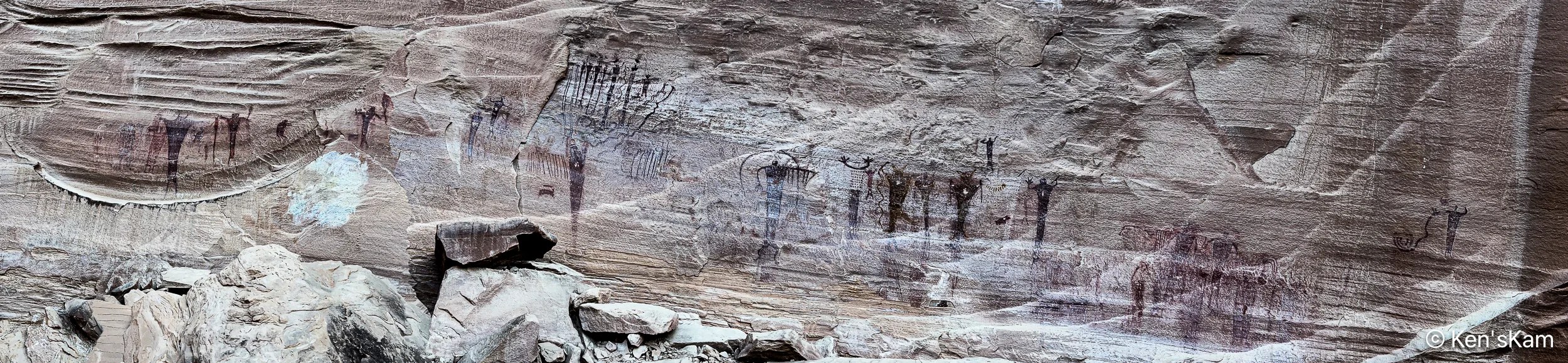
There are a couple of easily accessible Native American artwork panels on rock faces along this drive. One requires walking up a slight incline to reach, but the most impressive one, Buckhorn Wash Petroglyph Panel, has a large parking lot and is literally right at the edge of the parking lot.
The Buckhorn Wash Petroglyph panel is long. Much longer than this panorama might indicate. I made this panorama with my iPhone by walking fast from one end of the panel to the other, trying not to trip and fall on the rocky, uneven surface. I was inspired to do this, after watching my son do it. Otherwise, I might never have thought to do a pano in this manner.
The following images are shots of small portions of the panel, showing details of some of the pictographs.
There are a number of signs placed in front of this panel with information and questions about what these images mean and how newer cultures came along and modified the older pictographs. And, yes, even modern day vandalism. In fact much damage to this panel was partially repaired in 1995.
Information Sign at Buckhorn Wash Petroglyph Panel
Please refrain from defacing such ancient records. These are already fading away due to natural weathering. Don’t accelerate the loss.
It is spring (or almost) and time for another spring trip with my oldest son. Traveling in the U.S. for outdoor activities in the spring, one always has to consider the weather at potential destinations.
The initial plan this year was to fly into Portland, Oregon, drive to Cannon Beach for photography along the Oregon coastline, knowing that the typical rainy weather along the coast might result in last minute changes, and it did. The forecast for the time interval available for this trip was for cool, rainy, overcast weather every day, which can offer some opportunities for photography, but might not be so pleasant every day. So cancel plan A. Move to Plan B.
Plan B was to go to the same area as last year, where there were still some possibilities to see and photograph in some locales not visited during previous trips. Then a few days before executing Plan B, Plan C came up. Plan C was to explore an area of Utah seen superficially and partially, when passing through on the way to other destinations. Plan C was executed.
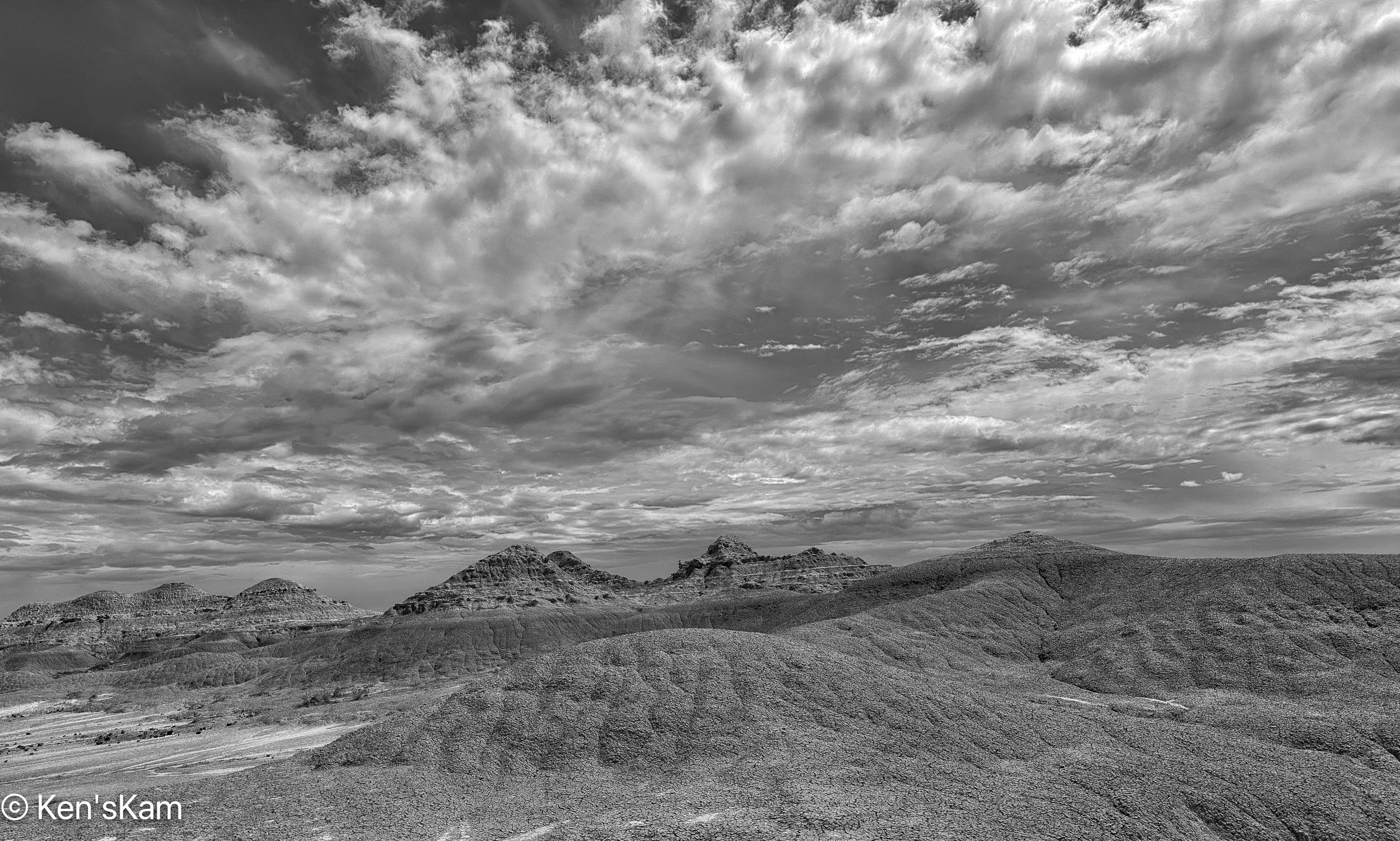
I drove two long days to reach the first destination, a first come first serve, free camping area on BLM (Bureau of Land Management) public land not far off of I70 west of Green River, Utah. This area is said to be popular with off roaders and I wanted to be sure to get here to find a campsite before the weekend crowd arrived. As it turned out, while there were a few scattered campers, including those hauling their offroad vehicles, there was no large crowd and I easily found a suitable campsite, somewhat secluded from others.
I shot the sunset panorama standing on the roof rack of my vehicle. If one looks closely, the tops of a few other campers can be seen in this image.
My son met me here to begin our exploration, making this our initial home base. Before he arrived, I had some time to walk around this area, shooting desert scenes with my iPhone. So stay tuned for part 2 to see some of those images.
There is a hoodoo in Badlands National Park that is visible from the paved road through the park. Getting close to the hoodoo requires hiking down the steep slope from the roadway and a short hike.
I made numerous iPhone camera shots as I walked around the hoodoo to show how a hoodoo can look considerably different from different points of view.
At the very end of a visit to Badlands National Park several years ago, I thought I had found a really good place for sunset photography. So during this visit I found that location again and walked around during the day, scouting possible locations to return to at sunset. I used my iPhone camera to test a few compositions and capture a few micro-environmental images.
Retrieving our cameras in the early morning from the volcanic ridge adjacent to our campsite, where we had left them the night prior, shooting programmed shots of the night sky, we drove a short distance to another location that we had scouted previously for sunrise photography.
I had to hike across a wide area and up a slope to get to a good place for my first composition, after which there was not much time to set up prior to the sun rising over the hills to the east of our location. Just as I set up at my first location, the sun suddenly came over the horizon, before I was completely ready, not giving me enough time to test my compositions and I was not happy with the initial results.
I moved on to other locations hoping to salvage something from this morning’s efforts. When I first reviewed the images from this morning, I passed over them, thinking none were good enough to bother editing. Later I revisited those images and decided that some had merit.
Volcanic Dike Ridge and Boulders. Nikon D850, Nikon 14-24mm @ 17mm, f/11, 1/10s, ISO 64, edited in Adobe Lightroom and DxO Viveza and Color Efex Pro 4.
Our location was below another volcanic dike on a steep slope covered with boulders.
Volcanic Dike Ridge and Boulders. Nikon D850, Nikon 14-24mm @ 17mm, f/11, 1/13s, ISO 64, edited in Adobe Lightroom and DxO Viveza and Color Efex Pro 4.
The boulders and clumps of grass worked well as foreground; but I was still disappointed in many of my compositions.
Volcanic Dike Ridge and Boulder Strewn Slope. Nikon D850, Nikon 14-24mm @ 20mm, f/11, 1/15s, ISO 64, edited in Adobe Lightroom and DxO Viveza and Color Efex Pro 4.
I missed the best of the light this morning, due to not arriving early enough.
Volcanic Dike Ridge and Rocky Slope. Nikon D850, Nikon 14-24mm @ 24mm, f/11, 1/15s, ISO 64, edited in Adobe Lightroom and DxO Viveza and Color Efex Pro 4.
Maybe just the fact that I knew I had missed the best morning light biased me against these images in my initial review.
Rocky Slope and Volcanic Dike Ridge. Nikon D850, Nikon 14-24mm @ 20mm, f/11, 1/15s, ISO 64, edited in Adobe Lightroom and DxO Viveza and Color Efex Pro 4.
The problem with this location is that the very first early morning light looks good on that volcanic ridge, but then the sun is already fairly high in the sky, so the golden light is very fleeting. By the time the sunlight begins to move down the slope the best light is gone.
Rocky Slope and Valley View. Nikon D850, Nikon 14-24mm @ 24mm, f/11, 1/40s, ISO 64, edited in Adobe Lightroom and DxO Viveza and Color Efex Pro 4.
After shooting looking up the slope towards the ridge, I turned to the south and shot across the wide flat valley with the hills in the background, using boulders as foreground.
Valley View. Nikon D850, Nikon 14-24mm @ 24mm (before crop), f/11, 1/30s, ISO 64, edited in Adobe Lightroom and DxO Viveza and Color Efex Pro 4.
I was not really pleased with any of my images from this shoot and even considered not bothering to process some, including the last image in this post. However, after getting that last image selected for Flickr’s explore page, I’m glad that I took the time to process and share it. Be sure to click on the photos to view higher resolution ones on Flickr.
Having missed the best light this morning, we decided to return here again the next, and our final, morning here to try again.