Utah – March 2026 – Part 16

I’ve fallen behind in my normal blog post schedule, being preoccupied with other summer time activities. I’ll try to get back to a more regular schedule.

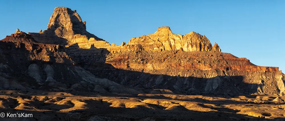
Sunrise Golden Hour 1

I used this geological feature as a foreground for star photography. As usual, I’m slow at processing those night images, so the star photos will have to be in a later post.

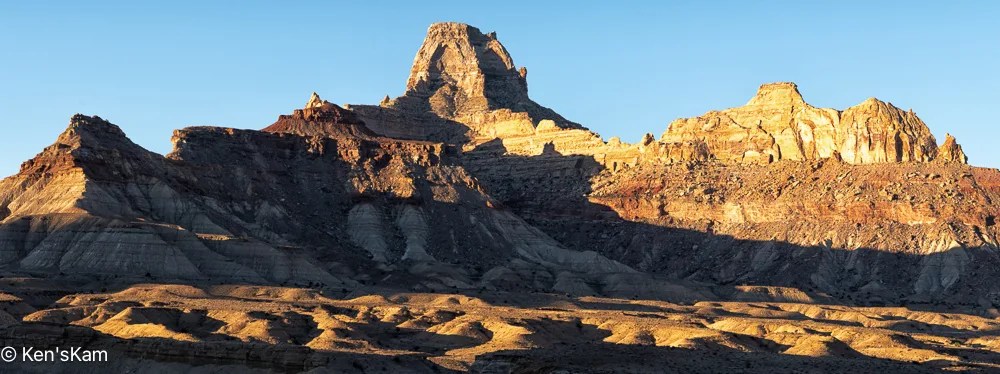
Sunrise Golden Hour 2
Sky Line
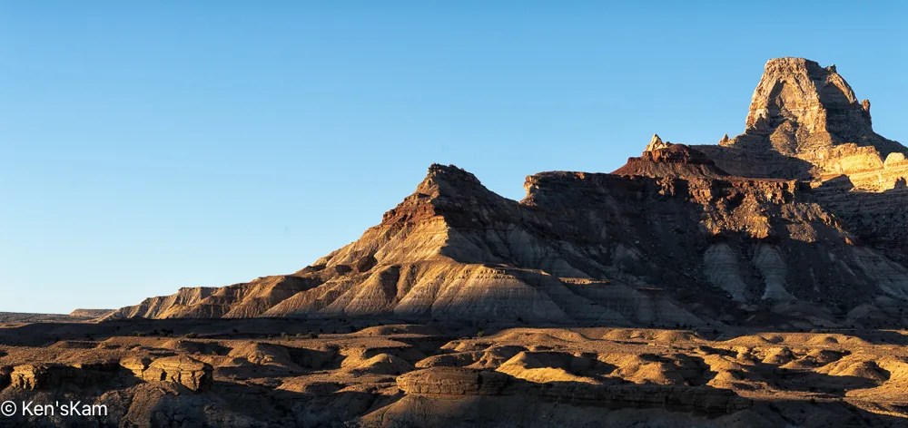
Sunrise Golden Hour 4
Early Morning Light

Most of the golden hour light was gone by the time I made ‘Early Morning Light’, but I really like the light and shadows on the undulating foreground.

After shooting sunrise from our campsite, we explored more of the local area, driving a number of side roads into the desert.

Crowns

These rock shapes remind me of crowns that might be worn by kings and queens.

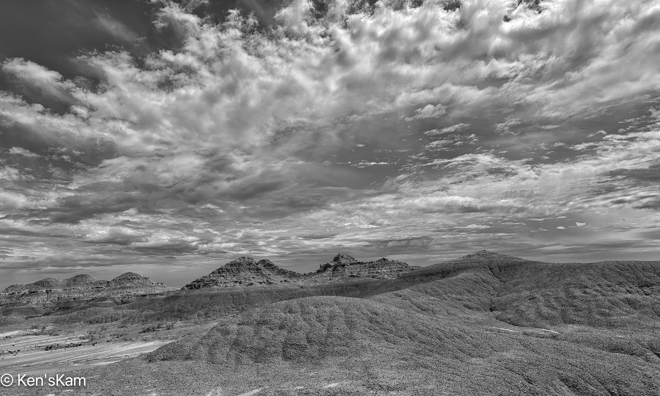
Desert Panorama
Sand, Plants and Hills

‘Sand, Plants, and Hills’ is a paraphrase from the Eagles’ song ‘A Horse with No Name’.

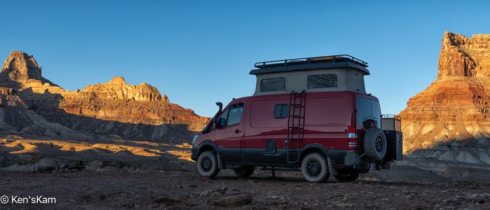
Gap Light

As evening approached, we set up for more night sky photography.

Thanks for following,

Ken


Utah – March 2026 – Part 15

There is an arch on a bluff just off of Buckhorn Draw Road, which we stopped to check out on our way back from Little Grand Canyon.

Arch Along Buckhorn Draw Road

As we drove back along the route we had taken to get to Utah’s Little Grand Canyon, we stopped to check out a side road near a large campground, where we were considering staying; but as we explored the side road, we discovered more interesting scenery and plenty of open campsites at which to enjoy the scenery.

Our Campsite off of Mexican Mountain Road, Utah

Look closely and my Sportsmobile can be spotted near the center of this image. If just glancing at the image, the Sportsmobile might be mistaken for a natural feature.

Campsite, Mexican Mountain Road, Utah

This zoomed in image shows the campsite location a bit better.

Mexican Mountain Road, Utah, Landscape Pano 1

This pano, made from our campsite, is of geological features across the roadway.

Across the Roadway 2
Across the Roadway 3
Near Sunset

We will shoot star photographs at this location. These images were taken not only to show the local scenery, but to select compositions for night sky foregrounds.

More local images and exploration images to follow,

Ken


Utah – March 2026 – Part 10

After miles of travel on gravel backroads, we arrived at Utah’s “Little Grand Canyon” or the “Wedge” as one viewpoint is called. This canyon does look similar to Arizona’s Grand Canyon, but on a much smaller scale. There are campsites (dry, and there were a few car/tent campers here) on the North end of the area and at least one pit toilet. The roadway through the camping area is rocky and rough, but nothing a normal passenger vehicle can’t handle.

Scouting at “The Wedge”
Hazy Canyon

The haze in the canyon is from a forest fire somewhere in the larger area.

Another View from “The Wedge”
At the Edge

On the Edge 2

After scouting, we returned to our base camp and relocated here for sunset, night sky and sunrise photography.

Thanks for following and stay tuned for more of Utah’s “Little Grand Canyon” photos.

Ken

Badlands National Park, June 2025 – Part 5 – Wildflowers

Near the hoodoo (last post) there were wildflowers, most with insects scrambling about on them, that I took time to photograph with my iPhone.

Prickly Pear Flower and Bud

I made numerous images of this and other nearby Prickly Pear flowers. I think this is my best shot.

And to back track a little, I had stopped along the gravel, backroad into the park to check out a possible area for late day photography and noted the numerous and varied wildflowers at the side of the roadway. the sun was high in the sky, so the lighting was not highly favorable for shooting the wildflowers, but I did so anyway using the camera in my iPhone.

Mariposa Lily

I also used the plant identification built into my iPhone to identify these wildflowers, so I hope my labels are accurate.

Common Dandelion?

Though my iPhone identifies this yellow wildflower with many petals as a ‘Common Dandelion’, these don’t look like the dandelions that commonly grow in my Texas lawn. So maybe Texas does not have ‘Common Dandelions’?

Sphaeralcia coccinea

The shiny leaves of this ‘Sphaeralia coccinea’ are mostly due to the bright sunlight reflecting from the petals.

Field Bindweed

I thought this wildflower was a form of the Texas Primrose, commonly referred to as a ‘buttercup’. Not so, according to my iPhone, which says it is ‘Field Bindweed’. The flower petals open more flatly than do those of the Texas Primrose.

And while the current topic is wildflowers, there are many in the Badland National Park. In my scouting stops along the main roadway through the park, I photographed many.

Yellow Sweet Clover
Once there were Flowers

And some spent flowers. ‘Once there were Flowers’ monochrome image was chosen for Flickr’s Explore Page.

Wildflower Fade
Yellow Salsify

More iPhone scouting photos to follow,

Ken


Badlands National Park, June 2025 – Part 4 – Dancing Around the Hoodoo

There is a hoodoo in Badlands National Park that is visible from the paved road through the park. Getting close to the hoodoo requires hiking down the steep slope from the roadway and a short hike.

I made numerous iPhone camera shots as I walked around the hoodoo to show how a hoodoo can look considerably different from different points of view.

Badlands Hoodoo 1
Badlands Hoodoo 2
Badlands Hoodoo 3
Badlands Hoodoo 4
Badlands Hoodoo 5
Badlands Hoodoo 6
Badlands Hoodoo 7

I think these make my point about “Dancing Around an Object” to photograph it.

Thanks for following and stay tuned for more Badlands scouting photos,

Ken
Badlands National Park, June 2025 – Part 3

At the very end of a visit to Badlands National Park several years ago, I thought I had found a really good place for sunset photography. So during this visit I found that location again and walked around during the day, scouting possible locations to return to at sunset. I used my iPhone camera to test a few compositions and capture a few micro-environmental images.

Big Sky over Badlands
Dry Planet

In ‘Dry Planet’ I wanted to show the similarity between the dry, white clay in the drainage patterns to the white clouds in the sky.

Anticipation

The dry drainage is waiting for more rain from those heavy clouds in the sky.

Dry Stream Bed

‘Dry Stream Bed’ features the same drainage as in ‘Anticipation’, from another view point.

The Missing Piece

The dry mud cracks into segments resembling a picture puzzle.

The Bigger Picture Puzzle

More scouting photos to come later,

Ken

Badlands National Park, June 2025 – Part 2

After photographing wildflower scenes around my campsite, I left the campsite to travel into Badlands National Park to scout locations for golden hour photography. But first, I drove around a little in the large public land area, where I was camped to get a better feel for the area and scout other possible campsites, in case my prefered location was again taken or the site I occupied on my first night here was taken, when I returned in the evening.

There are numerous road trails through this area, which is popular with off-road vehicle riders, who create their own trails with their dirt bikes, 4 wheelers and other vehicles. I traveled into the area a bit, but did not take time to fully explore the area, after I was satisfied that it would be no problem to easily find numerous suitable places to overnight here.

I parked along one of the trails on my way out, hiked up to the top of one of the many hills in this area and captured this pano:

Earth – Sky Pano

There is a gravel road that leads from the small town of Interior, SD into Badlands NP, which I take as a short cut into the park, rather than following the highway to a main entrance. There is a sign indicating when one is entering the park on this backroad, but no entry station. The sign does inform that a permit or fee is required to be in the park, so anyone in the park might be asked by a ranger to show proof of fee payment or other permit. I have a Senior Pass, one of the few benefits of old age, so I never worry about having to show proof that I can be in a National Park.

Eruption

I stopped on this gravel backroad to shoot a few images of the Badland features in the distance that appear to “erupt” out of the flat land in the foreground.

It was a mostly heavily overcast day with periodic light rain. I stopped at a number of the overlooks to snap a few scouting photos with my iPhone. The dramatic clouds in the sky made for interesting photos and I probably should have taken more time to capture better quality images with my Nikon Z8 and wide angle Z14-24mm lens. The Z8 is sealed well, but keeping rain drops off of the big lens glass can be a problem and I wanted to be able to scurry about quickly, so I left the big camera and lens in my vehicle, while I scouted various locations for shooting later in the day.

Big Storm over Badlands
Distant Spotlight

With the heavy cloud cover, not much direct light fell upon the badlands features, but occasionally a little light broke through the clouds to highlight some of the rocks.

Rugged Earth and Tempestuous Sky
Symmetrical Contrast

The shape of the mound of dry, cracked, gray earth in the foreground bears a similarity with the shape of the rain clouds in the sky, yet the dryness of that mound of clay contrasts with the wetness of the clouds.

Lushness and Barrenness

Lush green vegetation in the low areas contrasts with the almost barren rock in the background.

Meander

A meandering stream runs through the low area at the base of the badlands features.

More Badlands images later,

Ken

P.S. These images are best viewed on a large screen.


Badlands National Park, June 2025 – Part 1

In early June 2025, I traveled to Badlands National Park, South Dakota. I was not completely satisfied with my photos from this awesome national park from a visit a few years ago. I had some ideas of how to get better images during this visit.

I arrived late in the day and went directly to a BLM area south of the park that I had discovered during my last visit. At that time, I was often the only camper, at least as far as I could tell, in the area.

This time there was a camper in my favorite, quick and easy access spot. So I continued along a narrow dirt trail to find another suitable overnight location. This is a large area, so there are no shortages of possible parking/camping sites, but I was no longer alone in the area. There were no other campers nearby, but I could see one or two far away on higher locations. This place has been discovered, but is still sparsely utilized.

The forecast for the next morning was for heavy overcast and I was tired after my long journey, so I decided not to get up early for sunrise photography. Rather I explored a bit in this area and photographed the local scenery with my iPhone, including blooming cacti. As I drove around the area, I began to realize how big it was. I did not even explore to the limits of the area, before leaving and driving into the park to scout potential photography locations.

Prickly Pear Flower 1
Prickly Pear Flower and Bud
Threatening Sky
Prickly Pear Flower 2
Prickly Pear Flower 3
Mostly Clear Sky In This Direction
Prickly Pear and Companion Wildflowers
Prickly Sunburst
Rain Clouds Moving In
Prickly Back Light
Don’t Get Too Close
The Big Picture

Time to head out to see what I can find in the park,

Ken


Southern Utah March 2025 – The Nautilus

We were informed about a rock feature not far from our White House Campground by another visitor. So one afternoon we hiked to that feature from our campsite.

The hike was fairly short and relatively easy, requiring about 2/10 – 3/10 of a mile hike on the road into the campground, then another 1/4 mile or so in a sandy, dry creek bed.

The Nautilus

This rock feature is called The Nautilus, due to its twisting opening through a rock. That slope at the base of the hiker is much steeper than it looks in this image and the loose sand in it makes it a bit treacherous to walk up. Then there is another climb out on the other side that is not as steep. [This first image was chosen for Flickr’s Explore Page].

The Nautilus, Lower End
The Nautilus, Looking down the lower slope

This image gives a better indication of the narrowness of the lower section. Climbing up the narrow channel and making the sharp turn can be a little tricky with the slippery sand on the rock. At least this is true for adults. Small kids can easily and quickly navigate the slope and turn. It is easier and safer for us old kids to go around to the top, rather than going through the crevice; but I went through, anyway. I’m told by others that small kids like to slide down through this feature. Old kids might accidentally slide down and through, if they are not careful.

The Nautilus, Lower Wall Details
The Nautilus, View Through

Hugging the wall on the left, it is possible to get a view through to the other side of this twisted rock crevice.

The Nautilus, View from the top side
Island

‘Island’ is a small scene along the dry wash hike to The Nautilus.

Ancients

‘Ancients’ is another image made along the hike to The Nautilus.

Companions

‘Companions’ is an iPhone image of rock features in the walk in tent camping area of White House Campground.

This is the end of this short adventure. Stay tuned for more Utah rocks and landscapes.

Ken


Lake Tahoe, August 2024, Part 2

Finally, spotting what I knew had to be the Bonsai Rocks, I worked my way down and along trails to get closer.

August 15, 2024
Submerged Boulders
August 15, 2024
Bonsai Rocks and Lake Tahoe

These boulders in the edge of Lake Tahoe are obviously a popular destination for kayakers.

August 15, 2024
Boulders in Lake Tahoe
August 15, 2024
Bonsai Rock with Visitors
August 15, 2024
Bonsai Rocks in Lake Tahoe and Kayakers
August 15, 2024
Boulders, Kayakers and Lake Tahoe
August 15, 2024
Boulders, Lake Tahoe and Visitors
August 15, 2024
Boulder Explorers in Lake Tahoe
August 15, 2024
Bonsai Rocks, Lake Tahoe, Final Shot

If there had not been so many people climbing on and around these rocks, I might have gone down closer to the lake shore and spent more time photographing here, even though the light was harsh for getting the best images.

There were other beach areas that I wanted to visit, but this area in the summer months is much too crowded, and with numerous road construction projects along the route around the lake, getting around was slow and difficult, so I decided now was not a good time to try to get into those areas.

After lunch in North Lake Tahoe, we visited some local shops, where I chatted with a local photographer, who had many beautiful photos of this area and many of Bonsai Rocks at sunset and sunrise.  He said he did not go to Bonsai Rocks in the summer, because there were always too many tourist around.

Here is a link to that photographer’s webpage, where one can see the photographic possibilities in this area:  Bill Stevenson.

This wraps up photography from our August road trip.

Thanks for following,

Ken