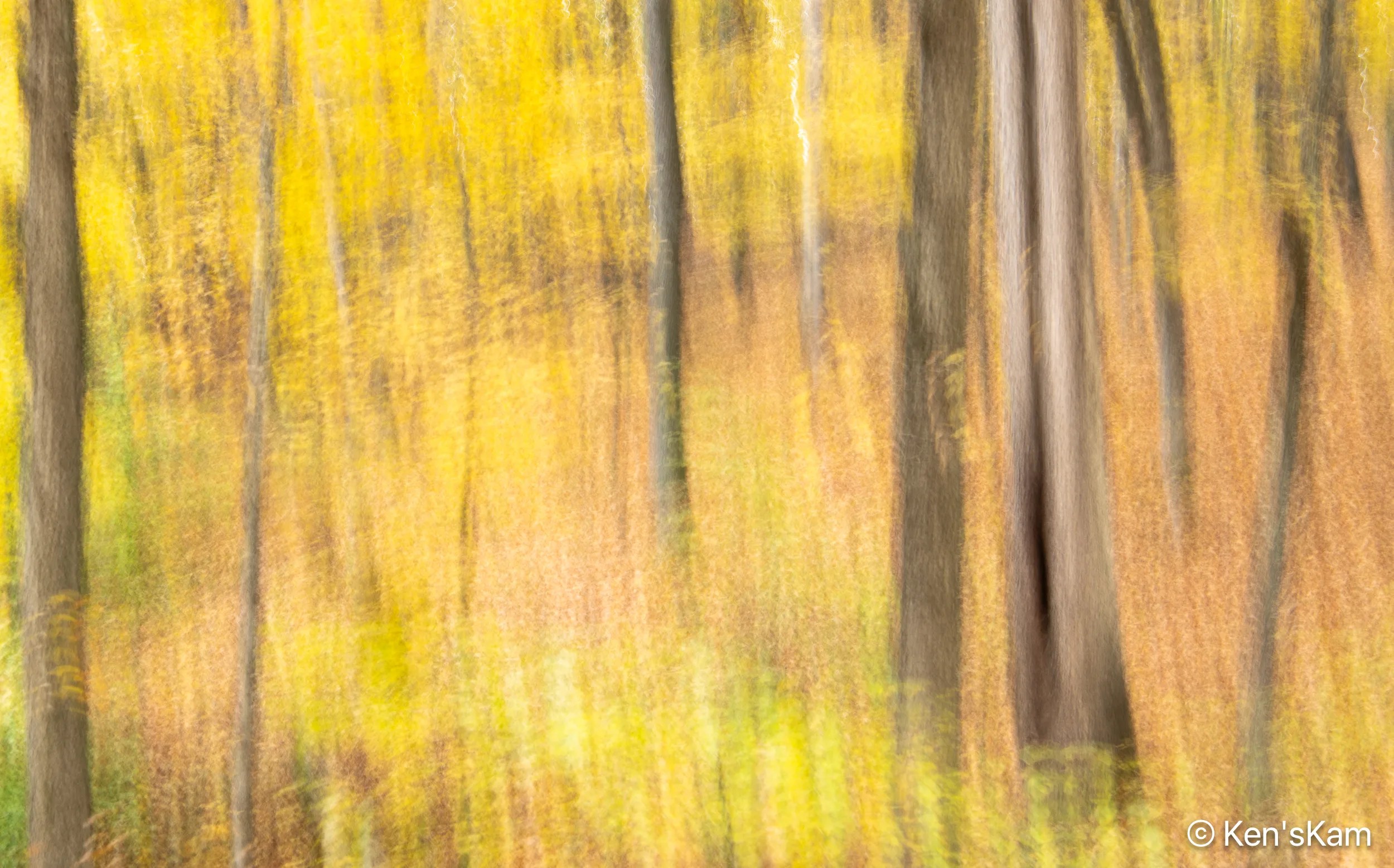
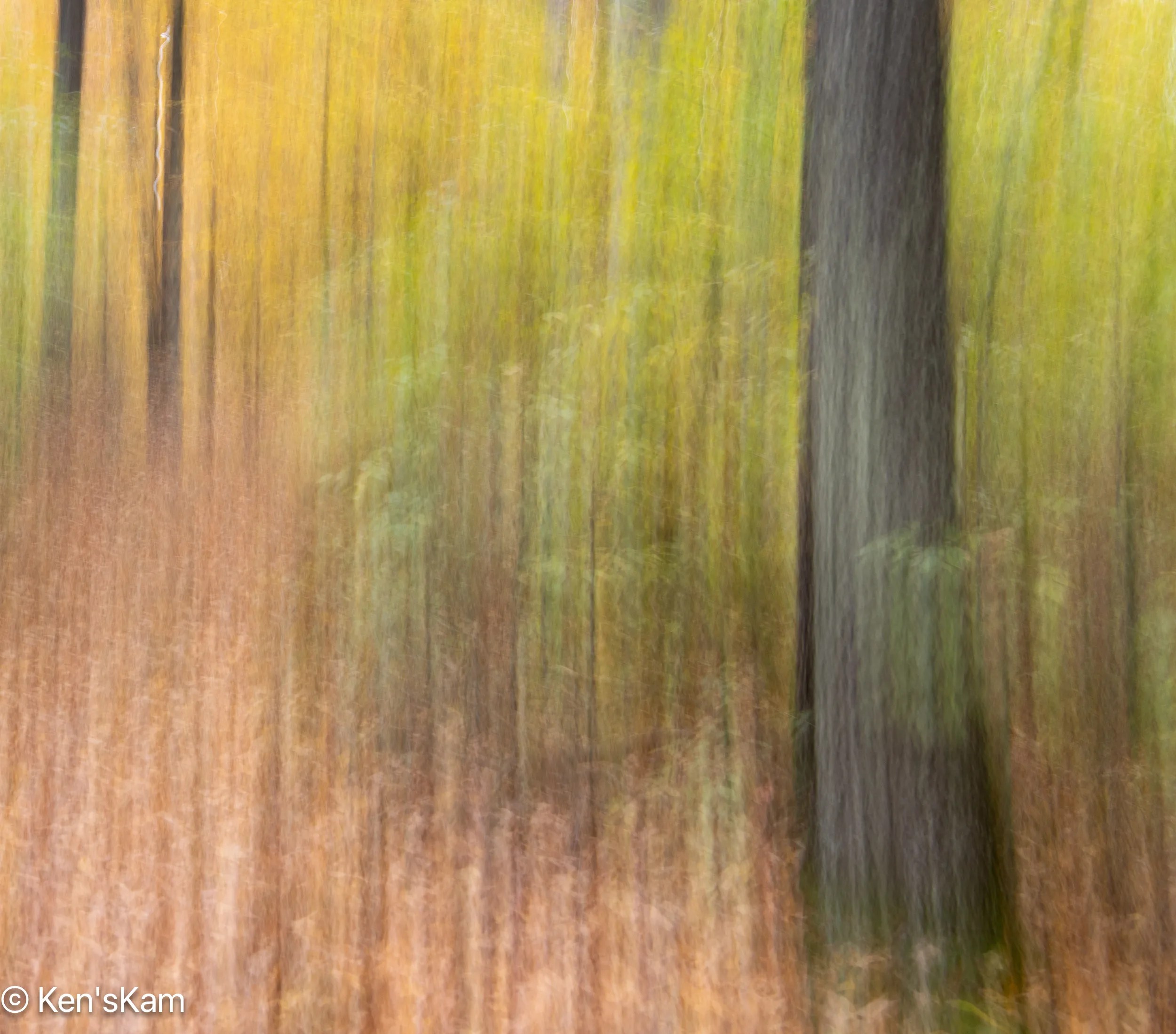
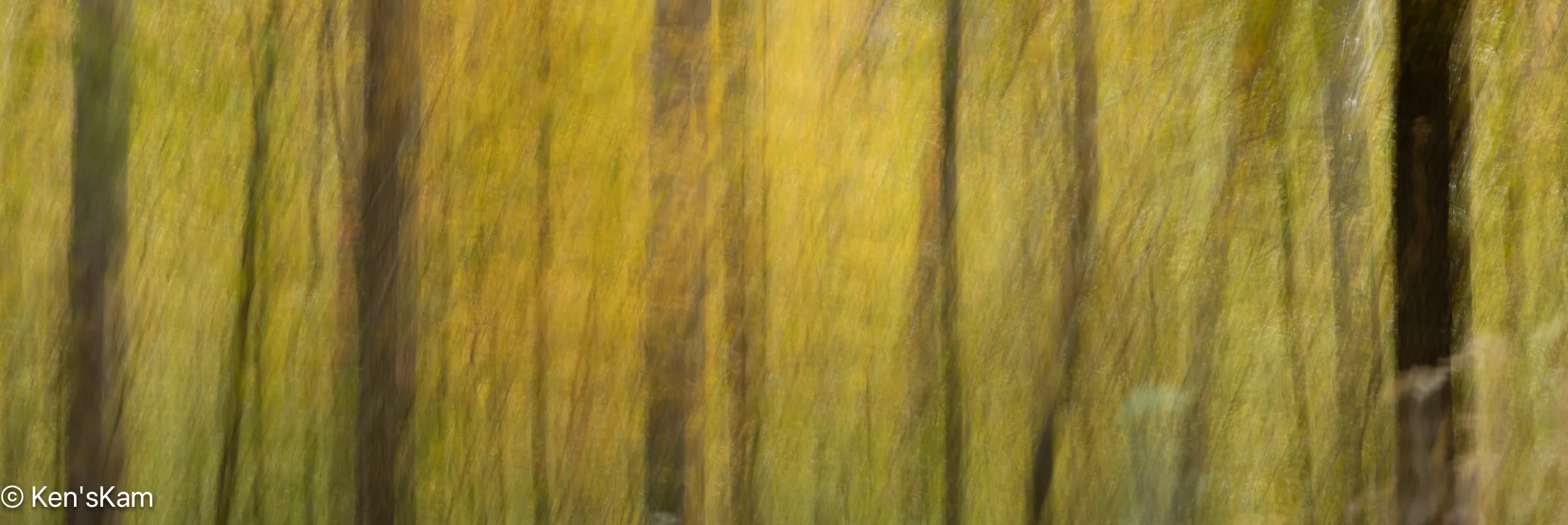
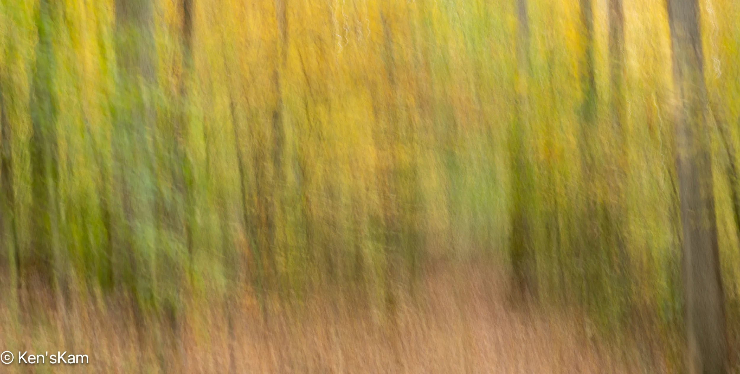
Whenever I think the ordinary forest scene photography is getting too repetivive and boring, I sometimes resort to ICM (Intentional Camera Movement) images. These are fun to do and there are no complicated rules of composition to try adhering to. Just use whatever aperture you like, a suitable ISO to avoid over exposure and a slow shutter speed (I usually use 1 second) and move the camera when the shutter is open. I think vertical movement yields the best results for vertical things, like trees, but other motions can be experimented with. Varying the speed at which the camera is moved yields different effects.
I suppose some might think these ICM images are similar and can become monotonous, too; but these are such fun to do that it can become addictive. These images were all created with a Nikon DSLR with a 24-70mm lens, but there are apps for phone cameras that allow such images to be created with your phone camera.
I met my son at White House Trail Head and Campground in Southern Utah to spend a few days hiking and photographing in the area in mid-March 2025. We had previously spent some time in this area in 2009. So we knew a little about the area and had some ideas about where to go and what to see, but we wanted to avoid some of the most popular areas, which tend to be the ones most easily accessible and are, consequently, crowded.
Yet, we did spend a fair amount of time driving around and hiking to check out some possibilities. We also had one really windy day that curtailed all but some driving exploration in the area.
We ended up going to one particular area a number of times at various times of the day. This area is not awfully difficult to get to, but it does involve a fairly long drive on gravel and dirt roads, with a long portion on a rugged, 4 wheel drive road, which probably keeps out many casual visitors, followed by a sandy hike. One has to know where this site is, otherwise it is not obvious from any roadway. We saw evidence of other recent visitors, but never saw anyone else during any of our vists here.
For those that are not familiar with the term, “Hoodoo” is used as a description of a pinacle of weathered rock, usually with curious shapes. My pareidolia causes me to see creatures is some of these rock features, so I will often name these hoodoos for what I perceive.
“Ghost Rocks” is an accidental multiple exposure, due to my forgetting to reset my camera menu from an earlier multiple exposure shoot; but I like it. Maybe I should have made more such multiple exposures here.
I called this area with the many hoodoos a “canyon”, but I’m not sure that is the best term. It is more like an area eroded down into a large flat plain, where the harder rock remains as pinacles with rock caps of various colors and sizes. “Rim View” is a late day shot from the flat plain above the eroded out area.
The numerous rocks strewn over the canyon floor in Buckskin Gulch give evidence of the violence of currents that periodically rage through this canyon.
The sky and canyon walls are reflected in this muddy puddle, including the upper portion of the wall with the glow of midmorning light. We were able to pass this puddle by using the rocks on the left as stepping stones, then making a big step to the right onto a large boulder at the far end of the puddle.
Beyond the First Puddle
More pebbles and boulder in the pathway. This seems typical of Buckskin Gulch. Evidently, more water flows through this canyon than through Wire Pass.
No Dry Way Forward
The next puddle we came to was deeper and had no convenient stepping stones in it to facilitate passing without wading in the very cold water. This was an obvious turn around point for us, as we were not prepared to wade through the cold water. A small tour group turned around here, too; but one intrepid old fellow stripped down to his underwear and waded through. He moaned and groaned all the way through, then again as he apparently had to repeat the process at another puddle that we could not see around the bend here.
I made a number of images at this turn around puddle to capture the details in the canyon wall, the red, golden glow ahead and the reflections in the puddle.
It was a bit more awkward making that first step back across this first puddle, because of the location of the first boulder on the far side. I had to think about how to approach that first step, since a poor choice of step would put me into the cold water and maybe an unplanned cold bath. Once back on this side, I turned to get a parting shot with more of the canyon walls in this one. The dynamic range of light in these canyons creates a challenge getting a good exposure, so I bracketed several shots with different exposure settings, then combined those images into this one High Dynamic Range processed image.
After our shortened hike into Buckskin Gulch to the south of the Wire Pass exit, we hiked into the northern portion, which tends to be wider than the part to the south.
We soon came to another big, muddy puddle, at which we elected to turn around. Footprints in the mud attest to others wading on through the cold water. There was not as much water in this canyon the first time we visited here years ago and we were able to easily hike further into each of these portions back then.
After turning around here, we went back through Wire Pass, returning to the parking lot and then back to our campsite to plan the rest of the day.
Water flowing through this narrow chasm over many years have cut through massive sandstone rock formations, revealing the multiple layers in the rock walls and cutting impressive contour features into those rocks.
Mind the Step 3The Bend Ahead 2
Footprints of previous hikers cover the sandy path.
Wire Pass slot ends at a wide opening at its confluence with Buckskin Gulch. The Alcove is a massive feature carved into the rock wall near this junction.
Wire Pass is a narrow slot canyon, about 3/4 mile long that feeds into Buckskin Gulch, reportedly the longest slot canyon in the world. The trailhead for Wire Pass is about a 45 minutes drive, if the road conditions are good, from White House Campground.
This is a fee area, requiring a small fee for day use. The first time we came here in 2009, the parking lot was small. This area is much better known and much more visited now than it was back then. Now the parking lot is much larger and fenced with a metal bar/pipe type fence. This parking lot is also for the trailhead to The Wave, which requires a permit for access. Permits for The Wave are awarded via a lottery. I have registered for this lottery numerous times, in person and online, over the years, including for this trip, and I’ve never been successful at obtaining a permit.
For photography, the best time to be in the canyon is around mid-morning to maybe mid afternoon. So we did not need to get here super early, but we did want to beat the crowds, so we arrived in time to hike the mile in the sandy creek bed to the entry to the slot by mid-morning. There were already quite a few folks out, but not a big crowd.
It was a cold, but sunny morning. There had been snow fall the previous day, but the dirt road, going south from highway 89 was in fair condition. This road is impassable when it is really wet.
Just into the entry point, the first obstacle, a twisted, broken tree trunk spans across the slot, requiring either crawling underneath or climbing over. I went under one part and over the other. I don’t remember in which order.
This wedged in tree trunk was high enough on the wall to walk beneath and is an indication of why one does not want to go into such a canyon, when there is a chance of a flash flood.
Wire Pass is a typical slot canyon with varying widths through which to pass, but is never extremely narrow. But it is narrow enough that folks have to stand aside to allow others to pass.
Many years of flash flooding have eroded the walls into nicely contoured features and shapes. Light, which varies through out the daylight hours, from the top of the canyon provides varying color to the rock walls.
We were informed about a rock feature not far from our White House Campground by another visitor. So one afternoon we hiked to that feature from our campsite.
The hike was fairly short and relatively easy, requiring about 2/10 – 3/10 of a mile hike on the road into the campground, then another 1/4 mile or so in a sandy, dry creek bed.
This rock feature is called The Nautilus, due to its twisting opening through a rock. That slope at the base of the hiker is much steeper than it looks in this image and the loose sand in it makes it a bit treacherous to walk up. Then there is another climb out on the other side that is not as steep. [This first image was chosen for Flickr’s Explore Page].
The Nautilus, Lower EndThe Nautilus, Looking down the lower slope
This image gives a better indication of the narrowness of the lower section. Climbing up the narrow channel and making the sharp turn can be a little tricky with the slippery sand on the rock. At least this is true for adults. Small kids can easily and quickly navigate the slope and turn. It is easier and safer for us old kids to go around to the top, rather than going through the crevice; but I went through, anyway. I’m told by others that small kids like to slide down through this feature. Old kids might accidentally slide down and through, if they are not careful.
The Nautilus, Lower Wall DetailsThe Nautilus, View Through
Hugging the wall on the left, it is possible to get a view through to the other side of this twisted rock crevice.
On my final afternoon in Sedona in August, 2024, I decided to go back to Bell Rock and to take the trail up Bell Rock to shoot at sunset.
There were still tourist about, but not so many as during the middle of the day. I’m guessing most tourist had been out during the middle of the day and were back in town for dinner at this late time of the day.
The Bell Rock trail is a wide, gently sloped, gravely path at the beginning and becomes more rocky and steep fairly quickly. Yet, it is mostly easy, with a few big steps, with one notable exception.
I got to one point, where I was not sure where the official trail went. There was a big rock in front of me with an obvious trail marker on top of the rock. There were a couple of young, female hikers, sitting on a rock there, enjoying a late day meal. I asked them about the trail and they indicated that it had to continue on top of the big rock, but they could see no safe way they could continue. One either had to somehow climb the rock, which had a step like rock at its base or navigate a narrow crevice on the other side of the rock. They said it was their first day in this area and they did not want to risk an injury and not be able to enjoy the rest of their stay here, so they stopped at this point.
I considered my options and decided I agreed with them about the risk of continuing on the officially marked route. I looked around, considered and ruled out another option, before deciding I saw a possible route that I could access by backtracking a little.
That alternate route was still not as easy as it looked from a distance. It involved climbing up onto two rock ledges. I laid my tripod and camera up upon each of those ledges in turn and climbed up on my hands and knees (and those hard rocks hurt old knees). After a little more navigation, I got back onto the official trail. Now I had to hope that I could safely get back down.
I shot this panorama with my iPhone. The rock features from right to left are: Bell Rock, Courthouse Butte, Lee Mountain and unidentified ones on the far left.
Upon getting as high up on the Bell Rock slope as I could safely do, it was still well before sunset, yet most of Bell Rock was already in the shade of features to the west. It was obvious that the light illuminating the very peak of Bell Rock was the best “Golden Hour Light” that I would get today. So I made a couple of images and moved around on the rock ledge below this feature to photography the other local features.
This wraps up my photography in the area around Sedona, Arizona in August of 2024.
Thanks for following,
Ken
P.S. Obviously, I made it back down safely, otherwise this post would not exist. I took the official trail down, sliding down that big rock on my rear end until my feet reached the step rock at its base.
I had a limited time in Sedona and I had never been here previously, so I figured it best to visit the “easy” photographic targets, which were also popular ones.
I had visited the Bell Rock area on my first outing. Today, I planned an early morning shoot at Cathedral Rock. “Planned” is used very loosely. I had not scouted here, other than to drive through the parking lot one day. So I knew how to find the parking lot, but I had no idea about what was involved in hiking the trail nor did I have a scouted location from which to shoot.
There was only one other vehicle in the Cathedral Rock Trail parking lot, when I arrived in early morning dark. I could see lights on the slope at the base of the rock feature, so I figured there were early morning hikers out or maybe even one or more early morning photographers.
I had a quick snack, finished the cup of coffee I had brought from the motel, gathered my camera, tripod, headlamp and began walking through the parking lot, looking for the trailhead. In the dark, I walked past the trailhead, went into an adjacent parking area, where I encountered a small group of young people getting out of their vehicles. They greeted me in a friendly manner and I asked about the trailhead. They told me that I had just walked past it and where to find it. They also said I could follow them as they were headed that way. But I went ahead, just getting on the trail, when they quickly came in behind me. Seeing that they were experienced on this trail, had bright headlamps and were likely to be much faster hikers than me, I let them pass and fell in behind.
The trail was well defined, but rugged and a little steep as it headed uphill. After getting out of the forest on the lower slope of the trail, it became light enough that I did not need the headlamp and the young, energetic hikers rapidly gained ground ahead of me.
It was a warm, humid morning and I worked up a sweat before arriving at an open area beneath the Cathedral Rock feature. It was well before sunrise and I had a wide open view across the landscape to the east.
There were plentiful clouds in the sky and daylight was beginning to show in the distance. I made a few images of the pre-sunrise sky, then scouted around for a good place from which to shoot Cathedral Rock. I was disappointed at the views I had, looking up at that feature. The young hikers were nowhere to be seen and I assumed they had continued along the trail.
Cathedral Rock – My Initial View
I began to work my way up a dry drainage, trying to get to a better vantage point, taking time to check out various locations off to the side of the drainage, up the steep slope, where ever I could safely do so.
I never succeeded in getting a really good, open view of the most attractive portions of the unique rock features, but being well off of the beaten path, maybe I got views that other have not. Setting up for these shots was not easy either, at times I had to abandon my tripod and shoot handheld.
As I was shooting from well below these rock features, I kept hearing voices, which I hoped were not just in my head. Eventually, I realized the voices were coming from those young people I had followed part of the way up the trail and they were rock climbers, not just hikers. I could occasionally just barely make out one or two up on the rocks. That is when I realized that in the dim light, I had missed a junction in the trail that would have taken me to the base of these rocks. This is why knowledge of the area is important, when planning an effective photo shoot. So, someday maybe I will get back here and I will know where to go. But I can’t deny that I enjoyed the experience and challenge of exploring in the off trail area below the main feature.
Cathedral Rock – A wider view
If memory serves me correctly, I think I shot this image sitting on a narrow, slope ledge that I was able to pick my way onto above the dry drainage. The early morning clouds abbreviated the golden hour, which lasted for only a few minutes this morning.
Sedona, Arizona is in a picturesque setting with massive, colorful rock formations all around. It is also a popular tourist city with all the trappings of such a city, many shops, restaurants and art galleries.
In the outlying areas there are many popular hiking trails, scenic destinations and places popular with rock climbers.
My wife and I drove around the local area around the city to check out the scenery. I made mental notes about possible places to return to at sunrise or sunset to engage in my photography hobby.
My first chosen destination, Bell Rock, for a sunset shoot is just off of a major road and is a popular tourist draw. As I left our motel in Sedona, an afternoon thunderstorm erupted with lots of lightening and heavy rain. The local rock features that are visible from the city streets were surrounded by clouds with intermittent breaks in the clouds allowing sunlight to illuminate those features for a short while. There would have been great photographic opportunities during the storm, if only there had been a place to safely pull over out of the heavy late day traffic and not be exposed to the heavy rain and possible lightening. I could only observe and admire the views, wishing I were able to photograph the storm.
I hoped that there would still be some of the storm around when I arrived at the Bell Rock parking area, but the storm had moved on into the far distance by the time that I arrived. The nearby sky was mostly clear, but the distant storm clouds were still visible.
There are a number of hiking trails around and near Bell Rock. Most tourists opt to hike up the slope towards Bell Rock. I decided to hike the less popular trail that went around behind Bell Rock towards other rock features nearby. I only recall encountering two or three others on this trail. The parking lot was not nearly as full, this late in the day, as it had been during my scouting pass through it earlier in the day.
As these first two images reveal, the distant clouds caused the light to constantly vary from entire shade to partial shade and the sky to vary from dark to light.
I made numerous, not so interesting, photographs of the distant rock outcrops as the late day light changed. While the distant storm clouds added interest, it was not until I noted a faint rainbow appear that I began to hope for something more interesting. Indeed, as I watched the scene that rainbow became brighter and a double rainbow appeared, seemingly terminating on the rocks with a golden glow from the late day sunlight.
As I prepared to photograph this old, majestic tree skeleton (old trees like this are one of my favorite subjects), the clouds in the sky began to glow with the golden color of sunset light. The golden cloud was perfectly positioned above the tree, as if forming a crown of honor and remembrance for the old tree.
As I walked the trail back towards the parking lot, after my late day shoot, I had to stop to capture these colorful, post sunset clouds with the silhouette of rock formations in the foreground.
When I turned to look back at this rock feature, I noted that the color was a deeper red just after sunset. In researching this area, I had seen information that said these rocks looked best for photography just after sunset sunset. My observation confirms that statement.
Near Mono Lake there is a volcanic cone called Panum. Panum is not a dormant volcano. This area is monitored by geologists for any signs of activity that might signal another eruption.
There is a 2.1 mile loop trail around the Panum crater. My son and I hike a portion of this trail. Mono Lake and the Sierra Nevada are visible from portions of the trail.
Obsidian Sitter
Large chunks of obsidian are common along the hiking trail.
ObsidianMore ObsidianLayered Obsidian and PumiceLayers
In addition to the large chunks of obsidian there are common layered rocks of obsidian and pumice scattered around the area.
Relic – Monochrome of an old tree remnant.A view of the Sierra Nevada from the crater trail
A portion of the trail is visible in the lower portion of this image.