Badlands National Park, June 2025 – Part 3

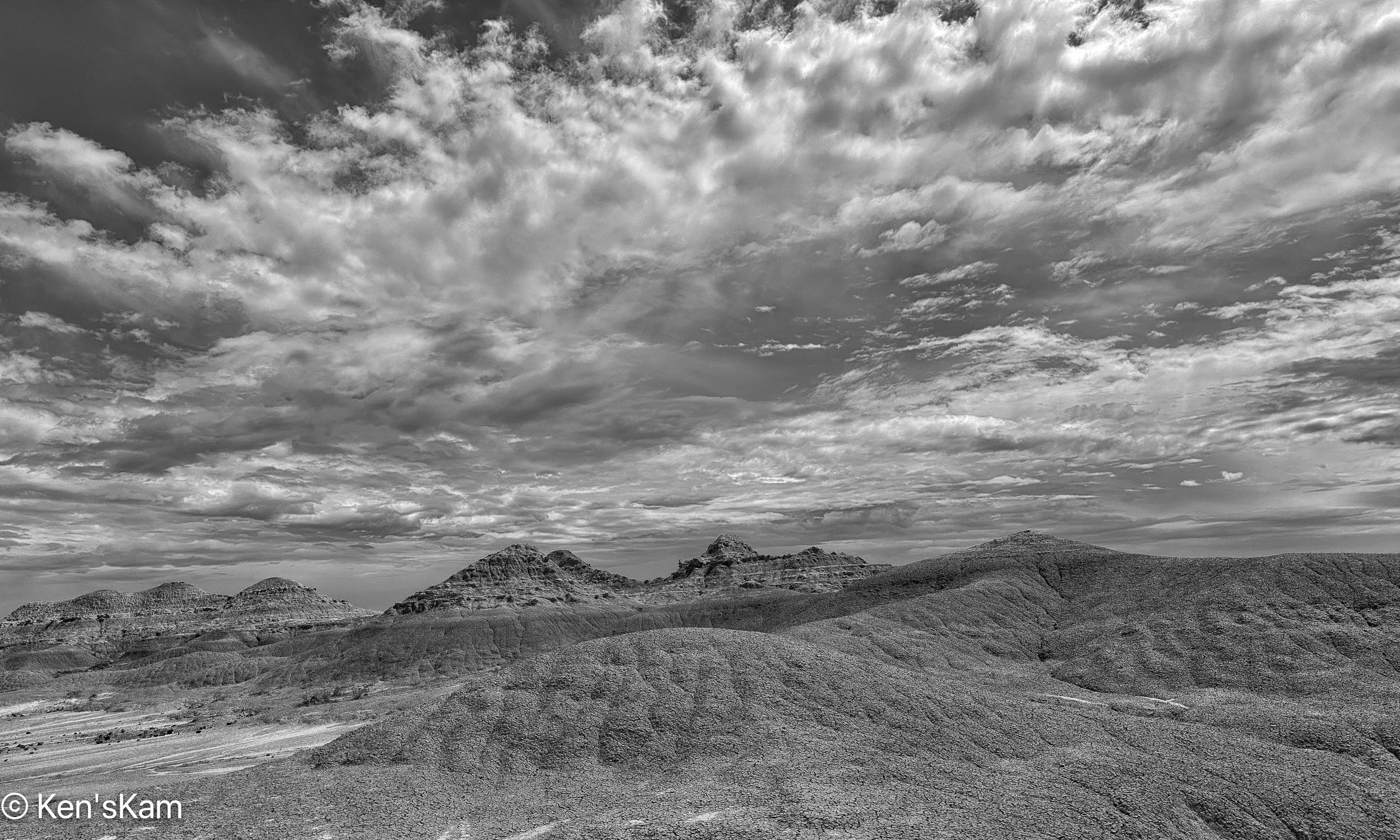
At the very end of a visit to Badlands National Park several years ago, I thought I had found a really good place for sunset photography. So during this visit I found that location again and walked around during the day, scouting possible locations to return to at sunset. I used my iPhone camera to test a few compositions and capture a few micro-environmental images.

Big Sky over Badlands
Dry Planet

In ‘Dry Planet’ I wanted to show the similarity between the dry, white clay in the drainage patterns to the white clouds in the sky.

Anticipation

The dry drainage is waiting for more rain from those heavy clouds in the sky.

Dry Stream Bed

‘Dry Stream Bed’ features the same drainage as in ‘Anticipation’, from another view point.

The Missing Piece

The dry mud cracks into segments resembling a picture puzzle.

The Bigger Picture Puzzle

More scouting photos to come later,

Ken

Badlands National Park, June 2025 – Part 2

After photographing wildflower scenes around my campsite, I left the campsite to travel into Badlands National Park to scout locations for golden hour photography. But first, I drove around a little in the large public land area, where I was camped to get a better feel for the area and scout other possible campsites, in case my prefered location was again taken or the site I occupied on my first night here was taken, when I returned in the evening.

There are numerous road trails through this area, which is popular with off-road vehicle riders, who create their own trails with their dirt bikes, 4 wheelers and other vehicles. I traveled into the area a bit, but did not take time to fully explore the area, after I was satisfied that it would be no problem to easily find numerous suitable places to overnight here.

I parked along one of the trails on my way out, hiked up to the top of one of the many hills in this area and captured this pano:

Earth – Sky Pano

There is a gravel road that leads from the small town of Interior, SD into Badlands NP, which I take as a short cut into the park, rather than following the highway to a main entrance. There is a sign indicating when one is entering the park on this backroad, but no entry station. The sign does inform that a permit or fee is required to be in the park, so anyone in the park might be asked by a ranger to show proof of fee payment or other permit. I have a Senior Pass, one of the few benefits of old age, so I never worry about having to show proof that I can be in a National Park.

Eruption

I stopped on this gravel backroad to shoot a few images of the Badland features in the distance that appear to “erupt” out of the flat land in the foreground.

It was a mostly heavily overcast day with periodic light rain. I stopped at a number of the overlooks to snap a few scouting photos with my iPhone. The dramatic clouds in the sky made for interesting photos and I probably should have taken more time to capture better quality images with my Nikon Z8 and wide angle Z14-24mm lens. The Z8 is sealed well, but keeping rain drops off of the big lens glass can be a problem and I wanted to be able to scurry about quickly, so I left the big camera and lens in my vehicle, while I scouted various locations for shooting later in the day.

Big Storm over Badlands
Distant Spotlight

With the heavy cloud cover, not much direct light fell upon the badlands features, but occasionally a little light broke through the clouds to highlight some of the rocks.

Rugged Earth and Tempestuous Sky
Symmetrical Contrast

The shape of the mound of dry, cracked, gray earth in the foreground bears a similarity with the shape of the rain clouds in the sky, yet the dryness of that mound of clay contrasts with the wetness of the clouds.

Lushness and Barrenness

Lush green vegetation in the low areas contrasts with the almost barren rock in the background.

Meander

A meandering stream runs through the low area at the base of the badlands features.

More Badlands images later,

Ken

P.S. These images are best viewed on a large screen.


Badlands National Park, June 2025 – Part 1

In early June 2025, I traveled to Badlands National Park, South Dakota. I was not completely satisfied with my photos from this awesome national park from a visit a few years ago. I had some ideas of how to get better images during this visit.

I arrived late in the day and went directly to a BLM area south of the park that I had discovered during my last visit. At that time, I was often the only camper, at least as far as I could tell, in the area.

This time there was a camper in my favorite, quick and easy access spot. So I continued along a narrow dirt trail to find another suitable overnight location. This is a large area, so there are no shortages of possible parking/camping sites, but I was no longer alone in the area. There were no other campers nearby, but I could see one or two far away on higher locations. This place has been discovered, but is still sparsely utilized.

The forecast for the next morning was for heavy overcast and I was tired after my long journey, so I decided not to get up early for sunrise photography. Rather I explored a bit in this area and photographed the local scenery with my iPhone, including blooming cacti. As I drove around the area, I began to realize how big it was. I did not even explore to the limits of the area, before leaving and driving into the park to scout potential photography locations.

Prickly Pear Flower 1
Prickly Pear Flower and Bud
Threatening Sky
Prickly Pear Flower 2
Prickly Pear Flower 3
Mostly Clear Sky In This Direction
Prickly Pear and Companion Wildflowers
Prickly Sunburst
Rain Clouds Moving In
Prickly Back Light
Don’t Get Too Close
The Big Picture

Time to head out to see what I can find in the park,

Ken


More Relics in Rural America – Part 5

This is a continuation of photography of old, abandoned homes or other structures that I’ve found, while traveling in middle America.

Stone House in Tall Grass

It is unusual for me to come across such finds as this late in the day with the sun low in the sky or with such great clouds in the sky from a clearing rain storm. I had to walk through tall grass to get near enough to shoot this old homestead in Middle America.

Tiny House in Tall Grass

This tiny house (or storage building?) is behind the bigger house (first image).

Maybe a Bath House?

Walking around to the back side of the tiny house, I found this pile of rocks from the collapsed structure, an old cast iron bathtub and other debris.

A Prince Came Calling

The title for this image is inspired by the small object I spotted in the upper left corner of the door frame. I know that object might be too small in this image for a viewer to identify, but it is an old Prince Albert tobacco tin. Prince Albert tobacco is still produced and it was very common and popular, when I was a kid growing up. Empty, discarded tins like this were common litter items back then.

Abandoned Prairie House and Windmill

There are two abandoned houses at this homestead, the one in the first image and the one in the image above.


Abandoned House, Windmill and Bathtub

Shooting the windmill from another direction, shows the first house and the tiny house in the background.

Like a Jigsaw Puzzle Scene
The Backside of House 2
One Side of House 2


Past and Future

There are modern electric power generating windmills on the far horizon in this image, indicating the continuity of wind energy in Middle America from the past into the future.

Open and Shuttered

Thanks for following,

Ken


Southern Utah March 2025 – White Rocks – Part 8

This is a continuation of multiple shoots in an area of Southern Utah known as ‘White Rocks’.

Morning on Hoodoo Planet

This first image on the Flickr Explore page.

Rock and Sky Striations
The Survivor and the Fallen
Standing Watch
The Loner
The Gathering
Rock and Sky
Hoodoo Ridge
Below the Daleks
The Shadow Knows
Reverence
Reverence 2

To be continued,

Ken

Southern Utah March 2025 – White Rocks – Part 4

More photos from Southern Utah, March 2025.

Mushroom Desert

If one looks very closely, for a sense of scale, there is a photographer in the upper left of this image.

Toes and Broken Nails
Hard Head, Soft Body
Evolutionary
Long Neck Hoodoo
Disintegration
Mushroom Valley
Desert Llama
Desert Sky
Level Headed Backup

Thanks for following and stay tuned for more Utah landscape photographs,

Ken

Southern Utah March 2025 – White Rocks – Part 2

Broken Circle

This post is a continuation of photography in an area of Southern Utah that is commonly referred to as “White Rocks”. There are many interesting rock features in this area.

I have to admit to cheating a little in the editing of this first image. In the original image there was a big rock where the two in the foreground are now. I found that single, large rock distracting, so I used Lightroom’s AI tool to break that rock into smaller rocks. This tool is often used to remove objects, but it can also modify objects. the tool creates three choices from which to choose at each activation and one can repeat the activation, if none of the choices are desirable. I could have completely removed that big rock, but that did not seem appropriate, so I chose this broken rock alternative, which I think fits better with the other rocks in the “Broken Circle”.  Some will object to this blatant modification of a landscape, but I’ve finally gotten to the point of seeing such photography as much as art as in faithfully copying what nature provides. So I’m ok with modifications, within reasonable limits and we have to use our own judgment as to what is “reasonable”.

Temple Guardians
A Toad’s Stool

Geologist refer to these rock features as “hoodoos” or “toadstools”. To me the rock atop the pedestal in the foreground here looks like a toad. So Maybe this is a “Toad’s Stool”.

Parent and Child

I titled this “Parent and Child”, but I can also see it as a dog with its tail sticking up. Some people’s pareiodlia may see it otherwise, but in the end it is another of natures marvelous creations, no matter how we perceive it.

Surveying its Domain

This hoodoo, supported by many rock layers, seems to be looking down into the valley at those which lie below its lofty perch.

Parent and Child 2

I made this second image of “Parent and Child” a few minutes after the first, composing from a different angle. Within those few minutes, the sky in the background had changed significantly due to the windy conditions, illustrating how a minor change in view point and changing environmently conditions can affect a photograph.

Red Hat and Pink Bonnet

Just a pair of stylish, cartoon like hoodoos in Southern Utah.

Mom Hoodoo and Pet

A close up of the hoodoo with the pink bonnet in the previous image and a conversion to monochrome, give a completly different interpretation to this scene.

Hoodoo Family

Getting into a position to make this image was not easy. Steep slopes with gravel size rock chips and thin layers of sand over the hard rock surface and other obstacles, made moving around treacherous and positioning awkward.

Hoodoo Family Group Portrait

These hoodoos are the same one presented in individual photos. Grouping these into one shot, I’m imagining a father, child and mother in these rock shapes, all peering down into the valley below.

Hoodoo Family

Another group of hoodoos that look like a family unit. Dad in the background, mom on the right, casting a sideways look at the child in a curious manner.

That’s it for now. Stay tuned for more Southern Utah landscapes,

Ken


March 2025 Road Trip

It seems that my March road trips always involve some sort of drama. This year was no different. The first day of my trip was extremely windy. Driving through the Texas Panhandle towards Amarillo, I held my speed down to 55-65mph due to the strong, steady and gusting winds. In spite of my reduced speed, the headwinds resulted in the lowest fuel economy that I have experienced in my Sportsmobile, which does not get very good mileage to begin with.  I saw 4 eighteen wheelers laying on their sides along the way and one other sizeable trailer of some sort on its side. The crosswind assist software in my vehicle kicked in at least once.

I made it to Amarillo, safely, where I stayed overnight.

The second day of my journey was better. It was still windy, but not so much as the day before. Although, I did drive through intermittent rain, sleet and snow.

Light Snow Begins, iPhone Photo
Low Visibility, iPhone Photo

The snow was heavy enough at times to reduce the visibility, but not to such an extent as to inhibit travel.

I-40 East of Albuquerque, NM, iPhone Photo

One of my favorite portions of I-40 west of Amarillo is that approaching Albuquerque, NM, with its gently rolling hills and scenic views. West of Albuquerque, near Grants and Gallup are attractive red rock outcrops which are another portion of this drive that I like.

I spent my second night in Gallup, NM, where the temperature got down to about 17 degrees overnight.

Travel the third day was much more pleasant, mostly sunny and clear. Although, from my overnight location, my directions took me along many miles of rough back roads on Native American lands, where the speed limit was 25mph for miles, before finally getting up to 35mph for many more miles. I felt like I was speeding, when I finally got into a 55mph zone.

Much of my travel on this third travel day in New Mexico and Arizona was through Native American lands, where the speed limits are often quite lower than elsewhere, but the scenery is often beautiful for mile after mile.

Straight On, iPhone Photo
Church Rock. iPhone Photo

I know that I’ve driven this route previously, but maybe it has been so many years that I don’t recall the scenes. For many miles, I could see a big rock feature far in the distance. Sometimes as the road changed directions, I lost sight of it for miles; but eventually my route took me right past it. So of course, I had to stop, hike up a hillside to photograph it. I later learned that this feature is called “Church Rock” and the creek just west of it is “Church Creek”.

Sometimes the sky puts on a show with a display that has to be captured.

Cloud Burst, iPhone Photo

There are always so many sight in route that I would like to photograph, but if I stopped for everything I want to photograph, I would never make my destination in the time interval alloted for travel.

So this is it for my few photos in route.

Stay tuned for more landscape photos,

Ken


Indiana Fall 2024 – Part 1

As has become a tradition with my wife and I over the past few years, we spend some time in Indiana in the fall, staying in a cabin just a little outside of Brown County State Park, Indiana’s largest state park and one that has beautiful trees and attracts many visitors during the leaf peeping season.

This year the fall color was sketchy, slowly developing and never fully developed due to warmer weather and drought. As a result, we stayed a week longer than we normally would this year and even in early November, the fall color never quite achieved its normal full blown coverage, which is not to say that the fall was not beautiful and enjoyable, just not as good as previous years.

Ogle Lake 1, Brown County State Park, Indiana October 16, 2024

A couple of days after we arrived in Indiana, there was a full moon. So even though the fall color was just beginning to show in most trees, I went into Brown County State Park to shoot the moon rise over Ogle Lake. I arrived early to pick a location from which to shoot the moon rise. I have a couple of apps on my iPhone, which I use for determining where the sun and moon rise and set. I used one of those to determine a good shooting location, yet there is always some uncertainty in determining where exactly those events might first show up on the local horizon. After walking around a bit I picked a couple of spots that I thought would work well, then I retrieved my camera and tripod from my vehicle and went to my first choice, which was atop a concrete cover of an overflow drain for the lake, only to discover that a late day fisherwoman had taken that spot for some late day fishing. I had noted a number of fishermen along the north bank, which has a number of clear areas that seem popular with fishermen. I then proceeded to my second choice along the south bank at the end of the dam and set up there.

I made a number of shots from that location, while I waited for the moonrise. The lake surface had been rippled by wind, when I first arrived, but became very smooth and mirror like, when the wind abated.

Ogle Lake 2, Brown County State Park, Indiana October 16, 2024

Readers will note that the first two images in this post are the exact same composition. Yet the images are very different due to the clouds moving overhead.

While I waited, I kept an eye on my first chosen location, which had a good view right down the middle of the lake, hoping that the fisherwoman might abandon that location, which she did. I then went back to that location, making a few images there as I waited for the moonrise.

Ogle Lake 3, Brown County State Park, Indiana October 16, 2024

If viewers look closely, fishermen can be seen along the bank on the left of each of these images.

This lake is popular with visitors and more showed up as I waited. A few inquired what I was shooting and noted my wide angle lens, which I had chosen to capture the scene. I knew the wide angle lens would make the moon look small and I had some reservations about that. I had my 24-70mm and 80-400mm in my vehicle, which I thought about retrieving so that I could zoom in on the moon, when it came up, but I decided to stick with the wide angle to include more of the lake and forest in my images.

A local photographer with young clients came along, shooting her clients from the top of the dam with the lake and forest as background. I’m guessing she might have been doing engagement photos or some such social images. As she wrapped up her shooting, she asked me what I was shooting. She had not been aware of the expected full moon this evening. We talked for awhile and she mentioned how much she liked shooting at Yellowwood Lake in Yellowwood State Forest, which is not far away.  I have shot there a couple of times, during past visits to this area. In fact, I had encountered a female photographer shooting a young couple there the first time I visited that area.  I think the photographer I encountered this evening is the same that I encountered a few years ago at Yellowwood Lake, although I did not mention that to her.  Small world.

Some of the passerby’s on the dam that I had chatted with, returned to say that the full moon was visible from the location, where I had first set up. I abandoned my first choice and hastened back to my second choice, where the full moon was already visible.

Moonrise 1

I made the image above from the dam, just above where I first had set up at the lake edge. I wanted to get some of the vegetation along the lake edge as foreground, before going down to the lake edge.

Ogle Lake 5, Brown County State Park, Indiana October 16, 2024

This final image is from the south lake edge just below the dam. Of course, I made numerous other images, but these are representative of those.

I am a little disappointed that I did not have my 24-70mm with me, so that I could change lenses and get a closer shot of the moon, but at the time, I thought that I would return again the next evening to shoot the moon rise again. Something prevented my going out that next evening. Lesson learned, take advantage of shooting opportunities, whenever possible.

More fall photos coming up,

Ken


Sedona, Arizona – Part 4

On my final afternoon in Sedona in August, 2024, I decided to go back to Bell Rock and to take the trail up Bell Rock to shoot at sunset.

There were still tourist about, but not so many as during the middle of the day.  I’m guessing most tourist had been out during the middle of the day and were back in town for dinner at this late time of the day.

The Bell Rock trail is a wide, gently sloped, gravely path at the beginning and becomes more rocky and steep fairly quickly.  Yet, it is mostly easy, with a few big steps, with one notable exception.

I got to one point, where I was not sure where the official trail went.  There was a big rock in front of me with an obvious trail marker on top of the rock.  There were a couple of young, female hikers, sitting on a rock there, enjoying a late day meal.  I asked them about the trail and they indicated that it had to continue on top of the big rock, but they could see no safe way they could continue.  One either had to somehow climb the rock, which had a step like rock at its base or navigate a narrow crevice on the other side of the rock.  They said it was their first day in this area and they did not want to risk an injury and not be able to enjoy the rest of their stay here, so they stopped at this point.

I considered my options and decided I agreed with them about the risk of continuing on the officially marked route.  I looked around, considered and ruled out another option, before deciding I saw a possible route that I could access by backtracking a little.

That alternate route was still not as easy as it looked from a distance.  It involved climbing up onto two rock ledges.  I laid my tripod and camera up upon each of those ledges in turn and climbed up on my hands and knees (and those hard rocks hurt old knees).  After a little more navigation, I got back onto the official trail.  Now I had to hope that I could safely get back down.


Panorama at Bell Rock

I shot this panorama with my iPhone.  The rock features from right to left are: Bell Rock, Courthouse Butte, Lee Mountain and unidentified ones on the far left.

Bell Rock

Upon getting as high up on the Bell Rock slope as I could safely do, it was still well before sunset, yet most of Bell Rock was already in the shade of features to the west.  It was obvious that the light illuminating the very peak of Bell Rock was the best “Golden Hour Light” that I would get today.  So I made a couple of images and moved around on the rock ledge below this feature to photography the other local features.

Courthouse Butte
Lee Mountain – As seen from the slope of Bell Rock
Late Day View from Bell Rock
Lee Mountain (Left) and Courthouse Butte (Right)

This wraps up my photography in the area around Sedona, Arizona in August of 2024.

Thanks for following,

Ken

P.S.  Obviously, I made it back down safely, otherwise this post would not exist. I took the official trail down, sliding down that big rock on my rear end until my feet reached the step rock at its base.