My wife and I made a road trip from our Indiana cabin lodging to Madison, Indiana, during our traditional fall stay in Indiana.
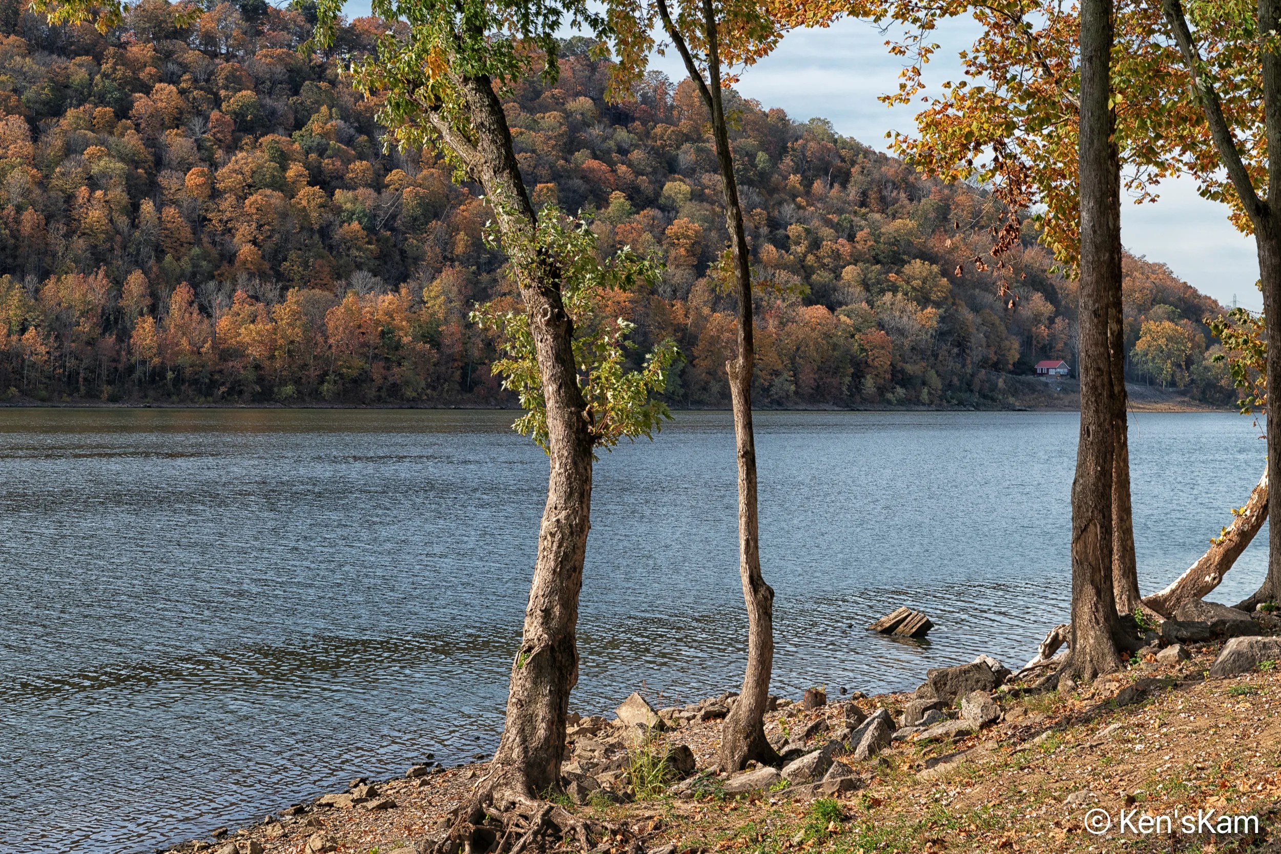
Madison is a picturesque, small city in Southern Indiana. There are a number of enticing antique and craft venues, favorite shopping for my wife, in Madison. A river runs through the area and one of the larger antique markets is located within sight of the river, maybe a block or two away, with open areas between that venue and the river and the park along the river. This provides me with an opportunity to walk around by the riverside, while my wife shops.
There were many of these trees with their red/yellow fall foliage along the streets and in the yards of homes in Madison and many fallen leaves beneath the trees and in the streets. This is probably a mundane fall event for those in this part of the country, but rare for one from Texas.
We were here a couple of days before Halloween. I noted natural features in the trees along the riverside that would make good Halloween photos. I captured images of a number of these features, but did not get the images processed in time for a Halloween post.
My online research suggested that Tunnel View at sunrise was a favorite Yosemite NP location for many photographers. I had not been happy with my evening photography at Tunnel View, so I decided to try again at sunrise.
I knew that this would require photographing directly into the rising sun and would be a challenge for getting a good exposure and timing would be critical for catching the first glimpse of the sun as it rose over the horizon.
The evening prior, I had shot with a 24-70mm lens, which did not let me acquire much detail of the distant rock features. So I opted to use my 80-400mm lens with a 1.4x extension at sunrise.
The sky was totally clear this morning, which was a disappointment, since the sky would be bland and uninteresting. Largely due to that bland sky, I converted the only reasonably good images I got this morning to monochrome.
I say pre-sunrise, only because the sun had not shown itself above the horizon that I see, but it is obviously already above the horizon behind this view.
The shadows in the sky cast by some of these rock features was a pleasant surprise and add interest to that bland sky. I especially like that dark streak radiating from the peak of Half Dome.
The sun rose at the right edge of Half Dome and this is the best image that I captured. I could have used software to enhance the sun’s starburst and brought up the shadows a bit more, but I like this more natural look, except for the bright halo behind the sun, which is a highlight that I could not avoid.
This is the second part of our final sunset shoot in March 2023 in Valley of Fire State Park, Nevada.
Rock Art
I’m always amazed at the rock sculpture nature provides for us to enjoy.
Wary Rock
There is definitely a wary looking face in this rock that appears to be watching me as I make this image. Maybe this rock has had bad experiences with humans in the past.
Sandfall
While the image may not be a greatly attractive scene, I found it interesting enough to take time to capture it. There is much texture, interesting rock shapes and lines running through the rock. The image name is for the narrow wash in the center that has an accumulation of sand at the bottom center.
Catcher’s Mitt
I moved to the right from the last composition to make this image, which shows off some of the more interesting features in the rock. The rock at the top, with its concave erosional form reminds me of a baseball catcher’s mitt. With the Texas Rangers clinching a berth in the 2023 World Series, maybe this is an appropriate time to post this image.
Catcher’s Mitt
A close up, color version, of the “Catcher’s Mitt”.
Natural Shelters
Erosion has created holes in these rocks that I can imagine animals or ancient people using as shelters. Modern day man might even take temporary shelter in one of these in an emergency.
My son and I decided to walk from our campsite into the nearby area for a sunrise shoot on our final day in Valley of Fire State Park. The scenery near the campground is not as impressive as in other areas in the park, so I was not sure how this would turn out.
Monochrome Desert Morning 1
The early morning light enhanced the color in the rock features and highlighted the desert grasses, but as I edited the photos, I felt that a monochromatic treatment was more appropriate for many of the scenes that I captured.
The early morning light was good, the color in the rocks good and I always like the way the low elevation sunlight highlights the desert vegetation. To be sure the light quality was what drives us to get up early to photograph the landscape, but maybe it was the lack of spectacular features and the clear, bland sky that inspired me to go with monochrome for these few selected photos.
I’m still trying to decide whether to post other photos from this morning’s shoot or move on to our final sunset shoot. My indecision and the need to review more images, plus other distractions, might create an interruption of my goal of posting twice weekly.
This is a continuation of hiking and exploration in Valley of Fire State Park and nearby areas, Nevada. All of the photos in this post were shot with an iPhone 14 and converted to monochrome.
With a final destination of Badlands National Park, South Dakota, I needed stops in route to break up the long road trip. I searched the maps of the states I would travel through to get to the Badlands for possibilities. The first place that I noted in Oklahoma was the Wichita Mountains Wildlife Refuge, which is only a few hours drive from my home base. I searched online for information about the refuge and looked for photos taken in the refuge. The results of that research convinced me that I should spend a couple of nights in the refuge RV campground.
Prior to this visit, I had no idea that such a place was so close by and that there were actually old granite mountains in the southwestern part of Oklahoma. Since I was traveling just after the busy summer season, there were plenty of RV sites from which to choose. After consulting the online campground map, I chose a site that looked like it was conveniently located near the restroom facility and near hiking trails from the campground.
It turned out that my campsite was just across a campground road from the campground hosts. I stopped by to chat with the hosts, let them know that I had arrived, get updates on the campground rules and conditions and get their advice on locations for sunset and sunrise photography.
I find that most non-photographers have completely different concepts about sunset/sunrise photography than do photographers. Still it is good to get local knowledge, especially for first visits to a location. After checking out the locations on the refuge map of the hosts’ suggestions, I decided that I should check out the area around the campground first and scout the suggested areas the following day.
I walked around the campground to get my bearings, find the trails originating in the campground and check out those trails. The refuge map is sketchy. Others that I encountered during my exploration of the large refuge area, expressed the same frustration with the refuge map.
Hole In One, Wildflowers, iPhone Photo
There were pretty wildflowers growing in the campground area.
Spider Like Wildflowers, iPhone Photo
After some effort and hiking much farther around the campground, than should have been necessary, I found the trail that I wanted to explore. The trailhead was visible from my campsite, but the trailhead was not marked! There were also branches along the trail, some branches clearly traveled trails, some branches not so clearly used and it was not even clear that those branches were actually trails and there were no markings along the trails.
It was not an area that one could get lost in, during daylight at least, so I did not mind exploring and I eventually found my way to my chosen destination.
One branch of the trail went around nearby Quanah Parker Lake. After hiking portions of that trail, I could see no good views for sunset photography, so I chose a branch that went away from the lake. That branch took me through woods to the other side of the lake, which looked more promising for photography.
Quanah Parker Lake, iPhone Scouting Photo
There were plentiful Prickly Pear Cacti in this area.
Prickly Pear Spikes, iPhone PhotoLooking towards Little Baldy, iPhone Scouting Photo
In addition to checking out the lake, I was interested in the map feature referred to as Little Baldy. I was not really sure what to expect of Little Baldy nor where exactly it was, given the sketchy map, but I figured I would know it when I saw it.
On the way to Little Baldy, iPhone Scouting Photo
There were many granite rocks and boulders scattered around, so I experimented with using those as foreground objects and tried to visualize how the scenes would look at sunset and sunrise.
Little Baldy, iPhone Scouting Photo
When I spotted Little Baldy, I explored around and up its slope, trying to pick vantage points from which to shoot at sunset today and for sunrise the following morning.
Little Baldy, iPhone Scouting PhotoView from Little Baldy, iPhone Scouting Photo
Shooting with the sun low in the sky, one’s shadow often becomes a problem to deal with. Sometimes a desired composition just can’t be obtained without one’s shadow and compositional adjustments have to be made.
View from Little Baldy, iPhone Scouting Photo
Now that I know where I want to be at sunset, I just have to figure out the timing for departing my campsite and getting into place prior to sunset. I’ve now got a good idea of the most direct path from my campsite to my intended location, so all I have to do is time the hike. Doing so as I returned to my campsite, it turned out that the hike is only about 10-15 minutes. That is really convenient and means that I can return to camp after sunset shooting without hiking in the dark and I can even hike back for sunrise photos and not have to hike in morning darkness, either.
My readers have already seen many photos of some of the fantastic, massive geological features in the Cathedral Valley portion of Capitol Reef National Park. The long loop road through this area passes many such features. We did not have time to explore around all of these and certainly not time to visit each area for golden hour sunrise or sunset photography.
But we did stop and walk around at some of the more easily accessible areas near the roadway. Often, I would use my iPhone camera to capture the scenes, rather than lugging around a heavy DSLR and lens.
Magic Seeker, iPhone PhotoDesert Vortex – Sky and Earth, iPhone PhotoRock Power, iPhone PhotoCommander/Tower of Power, iPhone PhotoDesert Sentinels/Commander and Sidekick, iPhone PhotoCathedral Valley Scene, iPhone PhotoSky Partitioner, iPhone PhotoDesert Sun, iPhone PhotoSerpent Sky, iPhone PhotoHalo, iPhone Photo
This is a continuation of a late afternoon shoot at Strike Valley Overlook in Capitol Reef National Park.
The EdgeUndulationsShadow Remains
This old tree skeleton provided a number of compositional possibilities. I think this one is the best photo I got here. If there were only a few clouds in the sky…
Evening RestLife on Edge
I had hoped to get some of these compositions with sunset light on the foreground, but this area very quickly went into shadow before the best of the late day light.
Rock ClimbersStrike Valley Overlook and Waterpocket FoldStrike Valley Overlook and Waterpocket FoldFadingDay’s EndReceding
One of the most fascinating areas in Capitol Reef National Park is Cathedral Valley, located in the northeastern portion of the park. There are two access routes into/through this area from Utah Highway 24. The access closest to the visitor center requires a river ford, while the other, nearer Hanksville, does not require a river ford and gets into the most scenic portion much sooner than the river ford access point.
The geology in this area is varied and great for photography. We visited numerous times and only scratched the surface of the photographic opportunities here. I will devote a number of post to this area.
Cathedral Valley
Initially, we hit the most popular areas in this very large valley and scouted for the places we wanted to get to at golden hours, which was a challenge, given the many miles of driving to get here from our lodging and the limited time we had to work this very large area.
Cathedral Valley MonolithsCathedral Valley Monoliths
I see opportunities to organize my photographs of this area into themes, but rather than take the organizational time required for that at this time, I’m posting images in the order that they were taken.
Desert Shadows – Black and WhiteDesert Sand, Vegetation and Shadows – Black and WhiteDesert Life – Black and WhiteDead Grass and Shadows – Black and WhiteSunburst – Black and White