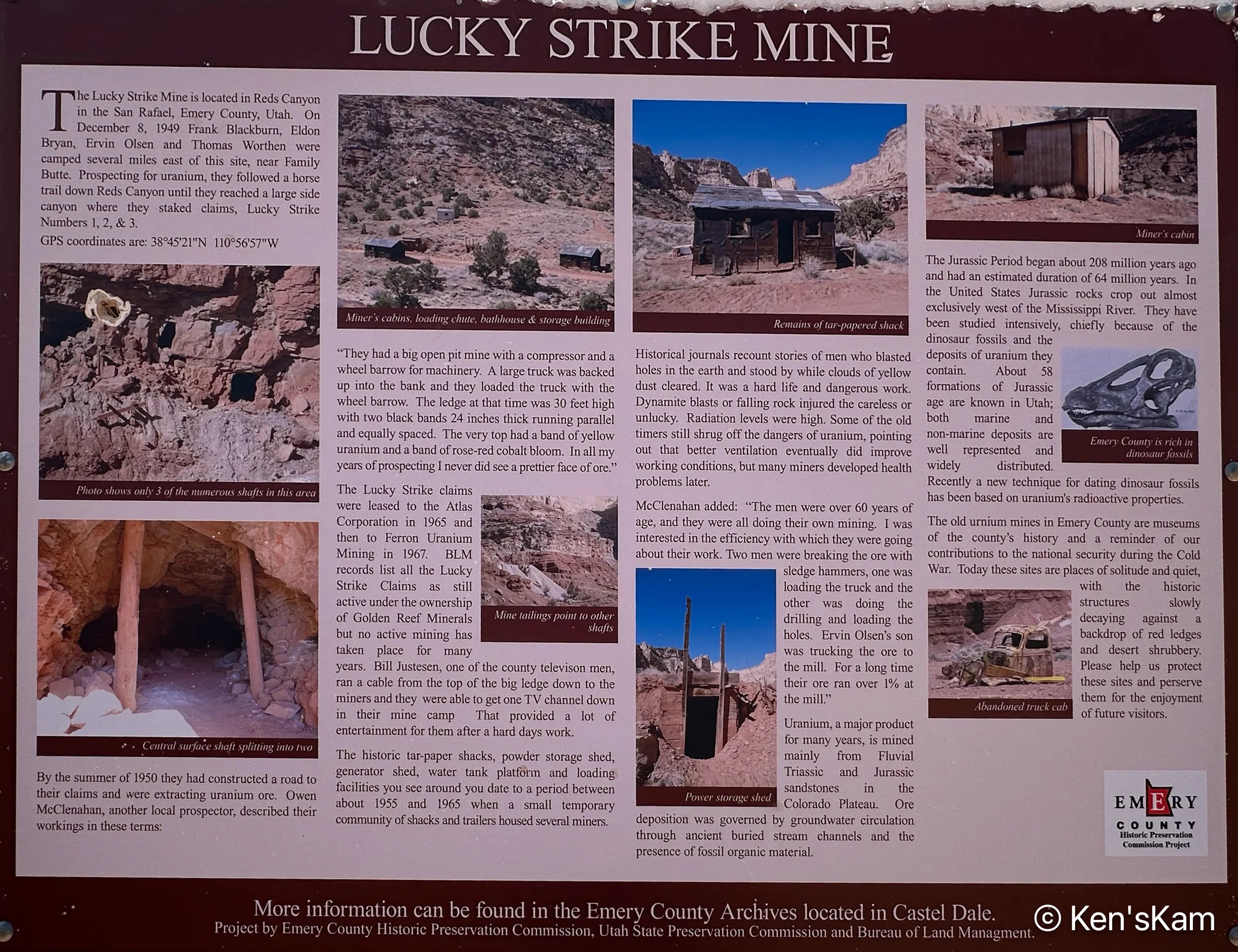
This old shack is at an abandoned uranium mine site called the Luck Strike Mine, which is actually still classified as “active”, even though there has been no activity here for many years. The small structure on the right of this image is a powder (explosive) storage shed.
This sign near the shack give a brief and interesting history of the mine and the lives of the miners who worked the mine, many of whom developed illnesses related to radiation exposure before there were any significant safety regulations regarding such activity.
Most of the photos in this post were made via an iPhone camera.
There are numerous 4 wheel drive roads readily accessible near our first Utah campsite. Portions of these roads do not actually require 4 wheel drive, nor high clearance vehicles, so ordinary passenger vehicles can get to some of the places revealed in this post, unless there have been rains sufficient to make the roads impassable, in which case even 4 wheel drive vehicles should avoid portions of these roadways.
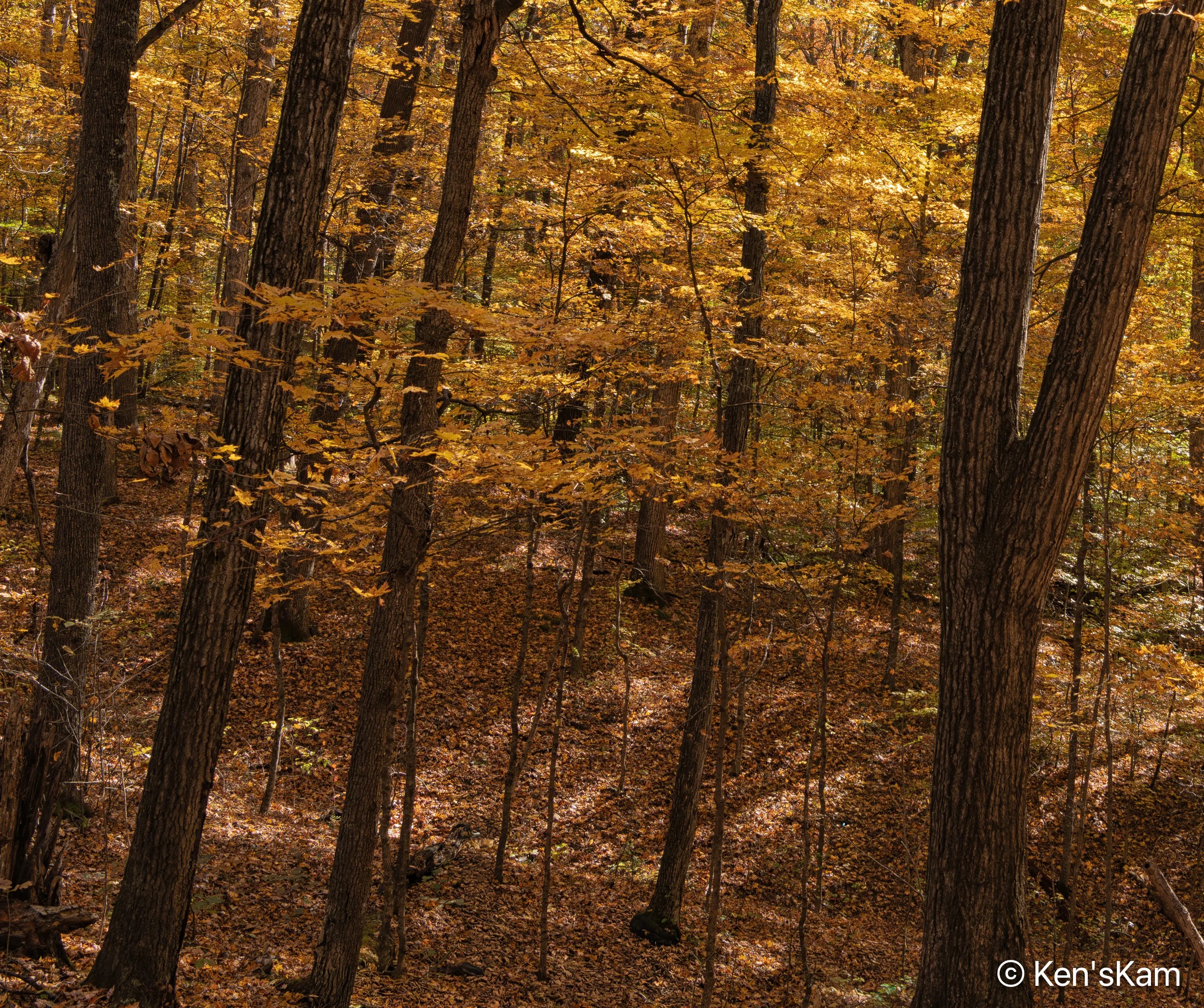
While waiting for my son to join me, I could not resist walking around the desert area surrounding my Utah campsite, capturing desert scenes with my iPhone camera.
I regret that I can’t find the poetry to describe these desert scenes. I’ve noted a few of my photography contacts on Flickr suddenly waxing poetic in a manner that suggest AI generated text. I have to admit, I’ve thought about that, but I’ve not yet given in to that temptation.
Thanks for following and stay tuned for more Utah desert scenes,
It is spring (or almost) and time for another spring trip with my oldest son. Traveling in the U.S. for outdoor activities in the spring, one always has to consider the weather at potential destinations.
The initial plan this year was to fly into Portland, Oregon, drive to Cannon Beach for photography along the Oregon coastline, knowing that the typical rainy weather along the coast might result in last minute changes, and it did. The forecast for the time interval available for this trip was for cool, rainy, overcast weather every day, which can offer some opportunities for photography, but might not be so pleasant every day. So cancel plan A. Move to Plan B.
Plan B was to go to the same area as last year, where there were still some possibilities to see and photograph in some locales not visited during previous trips. Then a few days before executing Plan B, Plan C came up. Plan C was to explore an area of Utah seen superficially and partially, when passing through on the way to other destinations. Plan C was executed.
I drove two long days to reach the first destination, a first come first serve, free camping area on BLM (Bureau of Land Management) public land not far off of I70 west of Green River, Utah. This area is said to be popular with off roaders and I wanted to be sure to get here to find a campsite before the weekend crowd arrived. As it turned out, while there were a few scattered campers, including those hauling their offroad vehicles, there was no large crowd and I easily found a suitable campsite, somewhat secluded from others.
I shot the sunset panorama standing on the roof rack of my vehicle. If one looks closely, the tops of a few other campers can be seen in this image.
My son met me here to begin our exploration, making this our initial home base. Before he arrived, I had some time to walk around this area, shooting desert scenes with my iPhone. So stay tuned for part 2 to see some of those images.
I made one final excursion into Brown County State Park near Nashville, Indiana in the early morning hours the first week in November 2025 to wrap up my fall photography for 2025. My first stop was at Ogle Lake to shoot the sunrise sky.
This is a continuation of 2025 fall photography in Indiana.
Ogle Lake Reflection
A Super Moon was on the calendar for one of my days in Indiana. So I went to Ogle Lake in nearby Brown County State Park to photograph the moon with its reflection in the lake. I chose my shooting position based upon where The Photographers Ephemeris App indicated the moon would rise.